Ocumicho geodata
Ocumicho (State of Mexico) is a populated place; located in Mexico in America/Mexico_City (GMT-6) time zone. With population of 3,438 people, there are 2650 cities with bigger population in this country. Compared to other cities in Mexico, 52.7% of cities are located further ↓South; 82.1% of cities are located further →East and 73.8% of cities have lower elevation than Ocumicho. Note1


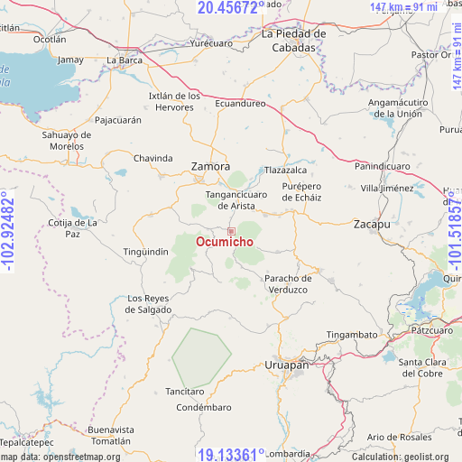
Ocumicho GPS coordinates[2]
19° 47' 47.544" North, 102° 13' 18.084" West
| Map corner | latitude | longitude |
|---|---|---|
| Upper-left | 20.45672°, | -102.92482° |
| Center: | 19.79654°, | -102.22169° |
| Lower-right: | 19.13361°, | -101.51857° |
| Map W x H: | 147.1×147.1 km | = 91.4×91.4mi |
| max Lat: | 32.7° ⇑47.3% North |
| Ocumicho: | 19.79654° |
| min Lat: | ⇓52.7% South 14.53588° |
| min Long | Ocumicho | max Long |
| -117.105° | -102.22169° | -86.73105° |
| W 17.9%⇐ | ⇒82.1% E |
Elevation
Elevation of Ocumicho is 2006 m = 6581 ft, and this is 752.3 m = 2468 ft above average elevation for this country.
| Max E: |
3497 m = 11473 ft | 26.2% |
| Ocumicho | 2006 m 6581 ft | |
| Avg. | 1253.7 m = 4113 ft | |
Min E: |
-1 m = -3 ft | 73.8% |
See also: Mexico elevation on elevation.city.
Geographical zone
Ocumicho is located in North Torrid zone (between Equator and Tropic of Cancer). Distance of this Northern Tropic circle is 404.8 km =251.5 mi to North.| Distance of | km | miles | from Ocumicho |
|---|---|---|---|
| North Pole | 7805.9 | 4850.4 | to North |
| Arctic Circle | 5200 | 3231.1 | to North |
| Tropic Cancer | 404.8 | 251.5 | to North |
| Equator | 2201.2 | 1367.8 | to South |


Nearby cities:
15 places around Ocumicho: (largest is in red/bold)
• Acachuén
14.6 km =9.1 mi,  67°
67°
• Chilchota
12.3 km =7.6 mi,  63°
63°
• Cocucho
11.8 km =7.3 mi,  163°
163°
• Colonia las Malvinas (Colonia Antorcha)
9.1 km =5.7 mi,  357°
357°
• Etúcuaro
14.4 km =8.9 mi,  42°
42°
• Huécato
9.6 km =6 mi,  121°
121°
• Los Nogales
9.6 km =6 mi,  45°
45°
• San Benito
14.4 km =8.9 mi,  226°
226°
• San Isidro
10.1 km =6.3 mi, 231°
• San José de Gracia (San José Ocumicho)
2.9 km =1.8 mi,  348°
348°
• Tanaquillo
14.1 km =8.8 mi, 66°
• Tangancícuaro de Arista
10.2 km =6.3 mi,  9°
9°
• Tengüecho
13.6 km =8.5 mi,  290°
290°
• Urengüitiro (San Martín)
10 km =6.2 mi,  238°
238°
• Urén
13.3 km =8.3 mi, 65°
Sources, notices
• [Note1] Compared only with cities in Mexico existing in our database
• [Src1] Map data: © OpenStreetMap contributors (CC-BY-SA)
• [Src2] Other city data from geonames.org with taken over terms of usage.
• [Src3] Geographical zone / Annual Mean Temperature by Robert A. Rohde @ Wikipedia
