Huajúmbaro geodata
Huajúmbaro (Michoacán) is a populated place; located in Mexico in America/Mexico_City (GMT-6) time zone. With population of 2,037 people, there are 4281 cities with bigger population in this country. Compared to other cities in Mexico, 50.1% of cities are located further ↑North; 71.4% of cities are located further →East and 86.6% of cities have lower elevation than Huajúmbaro. Note1


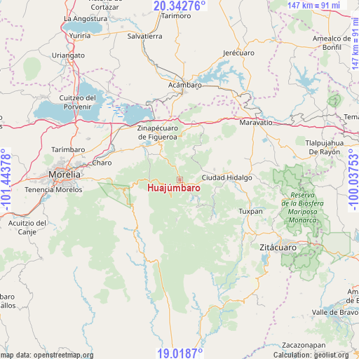
Huajúmbaro GPS coordinates[2]
19° 40' 55.56" North, 100° 44' 26.34" West
| Map corner | latitude | longitude |
|---|---|---|
| Upper-left | 20.34276°, | -101.44378° |
| Center: | 19.6821°, | -100.74065° |
| Lower-right: | 19.0187°, | -100.03753° |
| Map W x H: | 147.2×147.2 km | = 91.5×91.5mi |
| max Lat: | 32.7° ⇑50.1% North |
| Huajúmbaro: | 19.6821° |
| min Lat: | ⇓49.9% South 14.53588° |
| min Long | Huajúmbaro | max Long |
| -117.105° | -100.74065° | -86.73105° |
| W 28.6%⇐ | ⇒71.4% E |
Elevation
Elevation of Huajúmbaro is 2297 m = 7536 ft, and this is 1043.3 m = 3423 ft above average elevation for this country.
| Max E: |
3497 m = 11473 ft | 13.4% |
| Huajúmbaro | 2297 m 7536 ft | |
| Avg. | 1253.7 m = 4113 ft | |
Min E: |
-1 m = -3 ft | 86.6% |
See also: Mexico elevation on elevation.city.
Geographical zone
Huajúmbaro is located in North Torrid zone (between Equator and Tropic of Cancer). Distance of this Northern Tropic circle is 417.5 km =259.4 mi to North.| Distance of | km | miles | from Huajúmbaro |
|---|---|---|---|
| North Pole | 7818.6 | 4858.3 | to North |
| Arctic Circle | 5212.7 | 3239 | to North |
| Tropic Cancer | 417.5 | 259.4 | to North |
| Equator | 2188.4 | 1359.8 | to South |


Nearby cities:
15 places around Huajúmbaro: (largest is in red/bold)
• Colonia Ecológica Asociación de Lucha Social (Lucha Social)
13.8 km =8.6 mi,  87°
87°
• El Caracol
12.6 km =7.8 mi,  187°
187°
• El Chaparro
15 km =9.3 mi,  117°
117°
• El Porvenir
11.3 km =7 mi,  98°
98°
• José María Morelos
13.2 km =8.2 mi,  149°
149°
• Ojo de Agua de Bucio
11 km =6.8 mi,  6°
6°
• Pucuato
9.9 km =6.2 mi,  158°
158°
• Pueblo Viejo
13 km =8.1 mi,  323°
323°
• Rincón de Rubios
12.7 km =7.9 mi,  64°
64°
• San Antonio Villalongín
16.5 km =10.3 mi,  184°
184°
• San Bartolo Cuitareo
15 km =9.3 mi, 103°
• San Isidro Alta Huerta
11.7 km =7.3 mi,  66°
66°
• San Lucas Huarirapeo (La Mesa de San Lucas)
12.2 km =7.6 mi, 91°
• San Pedro Jácuaro
10.7 km =6.6 mi, 69°
• Tierras Coloradas (San Pedro)
10.7 km =6.6 mi, 67°
Sources, notices
• [Note1] Compared only with cities in Mexico existing in our database
• [Src1] Map data: © OpenStreetMap contributors (CC-BY-SA)
• [Src2] Other city data from geonames.org with taken over terms of usage.
• [Src3] Geographical zone / Annual Mean Temperature by Robert A. Rohde @ Wikipedia
