Pueblo Viejo geodata
Pueblo Viejo (Michoacán) is a populated place; located in Mexico in America/Mexico_City (GMT-6) time zone. With population of 1,044 people, there are 8345 cities with bigger population in this country. Compared to other cities in Mexico, 52.1% of cities are located further ↓South; 72% of cities are located further →East and 85.9% of cities have lower elevation than Pueblo Viejo. Note1


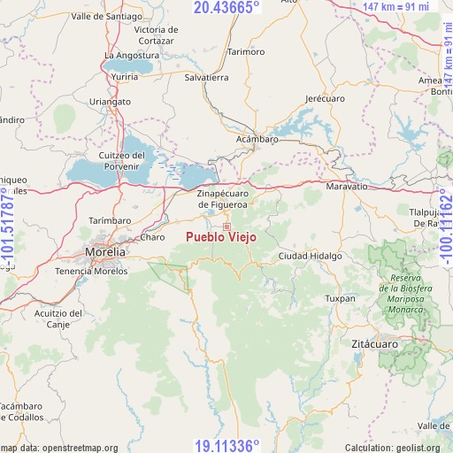
Pueblo Viejo GPS coordinates[2]
19° 46' 34.968" North, 100° 48' 53.064" West
| Map corner | latitude | longitude |
|---|---|---|
| Upper-left | 20.43665°, | -101.51787° |
| Center: | 19.77638°, | -100.81474° |
| Lower-right: | 19.11336°, | -100.11162° |
| Map W x H: | 147.1×147.1 km | = 91.4×91.4mi |
| max Lat: | 32.7° ⇑47.9% North |
| Pueblo Viejo: | 19.77638° |
| min Lat: | ⇓52.1% South 14.53588° |
| min Long | Pueblo Viejo | max Long |
| -117.105° | -100.81474° | -86.73105° |
| W 28%⇐ | ⇒72% E |
Elevation
Elevation of Pueblo Viejo is 2279 m = 7477 ft, and this is 1025.3 m = 3364 ft above average elevation for this country.
| Max E: |
3497 m = 11473 ft | 14.1% |
| Pueblo Viejo | 2279 m 7477 ft | |
| Avg. | 1253.7 m = 4113 ft | |
Min E: |
-1 m = -3 ft | 85.9% |
See also: Mexico elevation on elevation.city.
Geographical zone
Pueblo Viejo is located in North Torrid zone (between Equator and Tropic of Cancer). Distance of this Northern Tropic circle is 407 km =252.9 mi to North.| Distance of | km | miles | from Pueblo Viejo |
|---|---|---|---|
| North Pole | 7808.1 | 4851.7 | to North |
| Arctic Circle | 5202.2 | 3232.5 | to North |
| Tropic Cancer | 407 | 252.9 | to North |
| Equator | 2198.9 | 1366.3 | to South |


Nearby cities:
15 places around Pueblo Viejo: (largest is in red/bold)
• Araró
15 km =9.3 mi,  356°
356°
• Bocaneo (San Pedro)
6.9 km =4.3 mi, 357°
• Colonia de Guadalupe
10.9 km =6.8 mi,  284°
284°
• El Castillo
5.7 km =3.5 mi, 281°
• Huajúmbaro
13 km =8.1 mi,  143°
143°
• Indaparapeo
16.2 km =10.1 mi,  274°
274°
• José María Morelos (La Yegüería)
11.8 km =7.3 mi,  325°
325°
• Ojo de Agua de Bucio
9.1 km =5.7 mi,  87°
87°
• Queréndaro
8.8 km =5.5 mi,  294°
294°
• Río de Parras (Otzumatlán)
5.4 km =3.4 mi, 267°
• San Bartolomé Coro
14.6 km =9.1 mi, 334°
• San Lucas Pío
11.7 km =7.3 mi, 279°
• San Miguel Taimeo
7.6 km =4.7 mi,  13°
13°
• Santa Clara del Tule
5.4 km =3.4 mi,  346°
346°
• Zinapécuaro
9.4 km =5.8 mi, 351°
Sources, notices
• [Note1] Compared only with cities in Mexico existing in our database
• [Src1] Map data: © OpenStreetMap contributors (CC-BY-SA)
• [Src2] Other city data from geonames.org with taken over terms of usage.
• [Src3] Geographical zone / Annual Mean Temperature by Robert A. Rohde @ Wikipedia
