Pucuato geodata
Pucuato (Michoacán) is a populated place; located in Mexico in America/Mexico_City (GMT-6) time zone. With population of 638 people, there are 13580 cities with bigger population in this country. Compared to other cities in Mexico, 51.9% of cities are located further ↑North; 71.1% of cities are located further →East and 92.6% of cities have lower elevation than Pucuato. Note1


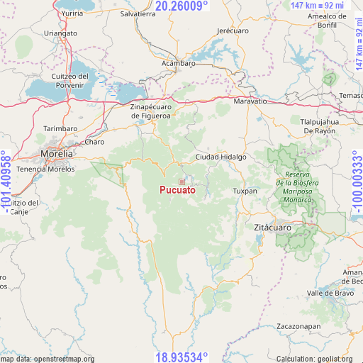
Pucuato GPS coordinates[2]
19° 35' 56.688" North, 100° 42' 23.22" West
| Map corner | latitude | longitude |
|---|---|---|
| Upper-left | 20.26009°, | -101.40958° |
| Center: | 19.59908°, | -100.70645° |
| Lower-right: | 18.93534°, | -100.00333° |
| Map W x H: | 147.3×147.3 km | = 91.5×91.5mi |
| max Lat: | 32.7° ⇑51.9% North |
| Pucuato: | 19.59908° |
| min Lat: | ⇓48.1% South 14.53588° |
| min Long | Pucuato | max Long |
| -117.105° | -100.70645° | -86.73105° |
| W 28.9%⇐ | ⇒71.1% E |
Elevation
Elevation of Pucuato is 2511 m = 8238 ft, and this is 1257.3 m = 4125 ft above average elevation for this country.
| Max E: |
3497 m = 11473 ft | 7.4% |
| Pucuato | 2511 m 8238 ft | |
| Avg. | 1253.7 m = 4113 ft | |
Min E: |
-1 m = -3 ft | 92.6% |
See also: Mexico elevation on elevation.city.
Geographical zone
Pucuato is located in North Torrid zone (between Equator and Tropic of Cancer). Distance of this Northern Tropic circle is 426.7 km =265.1 mi to North.| Distance of | km | miles | from Pucuato |
|---|---|---|---|
| North Pole | 7827.8 | 4864 | to North |
| Arctic Circle | 5222 | 3244.8 | to North |
| Tropic Cancer | 426.7 | 265.1 | to North |
| Equator | 2179.2 | 1354.1 | to South |


Nearby cities:
15 places around Pucuato: (largest is in red/bold)
• Agostitlán
11.4 km =7.1 mi,  126°
126°
• Colonia Ecológica Asociación de Lucha Social (Lucha Social)
14.2 km =8.8 mi,  45°
45°
• El Caracol
6.1 km =3.8 mi,  237°
237°
• El Chaparro
10 km =6.2 mi,  76°
76°
• El Porvenir
10.8 km =6.7 mi,  44°
44°
• Huajúmbaro
9.9 km =6.2 mi,  338°
338°
• José María Morelos
3.7 km =2.3 mi,  124°
124°
• Mata de Pinos
10.1 km =6.3 mi,  106°
106°
• Puente de Tierra
10.4 km =6.5 mi,  182°
182°
• San Antonio Villalongín
8.7 km =5.4 mi,  214°
214°
• San Bartolo Cuitareo
12.5 km =7.8 mi,  62°
62°
• San Isidro Alta Huerta
15.7 km =9.8 mi,  26°
26°
• San Lucas Huarirapeo (La Mesa de San Lucas)
12.4 km =7.7 mi, 44°
• San Pedro Jácuaro
14.4 km =8.9 mi, 26°
• Tierras Coloradas (San Pedro)
14.7 km =9.1 mi, 25°
Sources, notices
• [Note1] Compared only with cities in Mexico existing in our database
• [Src1] Map data: © OpenStreetMap contributors (CC-BY-SA)
• [Src2] Other city data from geonames.org with taken over terms of usage.
• [Src3] Geographical zone / Annual Mean Temperature by Robert A. Rohde @ Wikipedia
