Higuera Blanca geodata
Higuera Blanca (Nayarit) is a populated place; located in Mexico in America/Bahia_Banderas (GMT-6) time zone. With population of 1,360 people, there are 6390 cities with bigger population in this country. Compared to other cities in Mexico, 73.3% of cities are located further ↓South; 93.2% of cities are located further →East and 85.9% of cities have higher elevation than Higuera Blanca. Note1


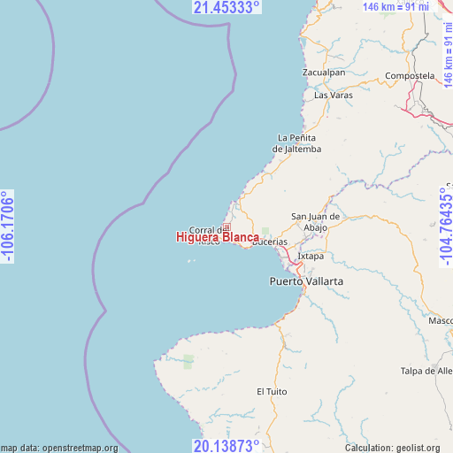
Higuera Blanca GPS coordinates[2]
20° 47' 50.856" North, 105° 28' 2.892" West
| Map corner | latitude | longitude |
|---|---|---|
| Upper-left | 21.45333°, | -106.1706° |
| Center: | 20.79746°, | -105.46747° |
| Lower-right: | 20.13873°, | -104.76435° |
| Map W x H: | 146.2×146.2 km | = 90.8×90.8mi |
| max Lat: | 32.7° ⇑26.7% North |
| Higuera Blanca: | 20.79746° |
| min Lat: | ⇓73.3% South 14.53588° |
| min Long | Higuera Blanca | max Long |
| -117.105° | -105.46747° | -86.73105° |
| W 6.8%⇐ | ⇒93.2% E |
Elevation
Elevation of Higuera Blanca is 39 m = 128 ft, and this is 1214.7 m = 3985 ft below average elevation for this country.
| Max E: |
3497 m = 11473 ft | 85.9% |
| Avg. | 1253.7 m = 4113 ft | |
| Higuera Blanca | 39 m = 128 ft | |
Min E: |
-1 m = -3 ft | 14.1% |
See also: Mexico elevation on elevation.city.
Geographical zone
Higuera Blanca is located in North Torrid zone (between Equator and Tropic of Cancer). Distance of this Northern Tropic circle is 293.5 km =182.4 mi to North.| Distance of | km | miles | from Higuera Blanca |
|---|---|---|---|
| North Pole | 7694.6 | 4781.2 | to North |
| Arctic Circle | 5088.7 | 3162 | to North |
| Tropic Cancer | 293.5 | 182.4 | to North |
| Equator | 2312.5 | 1436.9 | to South |


Nearby cities:
15 places around Higuera Blanca: (largest is in red/bold)
• Bucerías
14.6 km =9.1 mi,  108°
108°
• Corral del Risco (Punta de Mita)
5.8 km =3.6 mi,  242°
242°
• Cruz de Huanacaxtle
10.5 km =6.5 mi,  117°
117°
• Lo de Marcos
21.2 km =13.2 mi,  34°
34°
• Mezcales
20.6 km =12.8 mi, 111°
• Mezcalitos
21.4 km =13.3 mi, 115°
• Nuevo Vallarta
20.9 km =13 mi, 120°
• San Clemente de Lima
21.5 km =13.4 mi, 108°
• San Francisco
12.9 km =8 mi, 26°
• San Ignacio
7.3 km =4.5 mi,  41°
41°
• San Vicente
23.2 km =14.4 mi,  103°
103°
• Sayulita
8.6 km =5.3 mi,  19°
19°
• Tondoroque
18.9 km =11.7 mi, 107°
• Ursulo Galván
21.7 km =13.5 mi, 37°
• Valle de Banderas
22.8 km =14.2 mi,  87°
87°
Sources, notices
• [Note1] Compared only with cities in Mexico existing in our database
• [Src1] Map data: © OpenStreetMap contributors (CC-BY-SA)
• [Src2] Other city data from geonames.org with taken over terms of usage.
• [Src3] Geographical zone / Annual Mean Temperature by Robert A. Rohde @ Wikipedia
