Guadalajara geodata
Guadalajara (Jalisco) is a seat of a first-order administrative division; located in Mexico in America/Mexico_City (GMT-6) time zone. With population of 1,495,182 people, there are 3 cities with bigger population in this country. Compared to other cities in Mexico, 71.2% of cities are located further ↓South; 87.7% of cities are located further →East and 55.3% of cities have lower elevation than Guadalajara. Note1


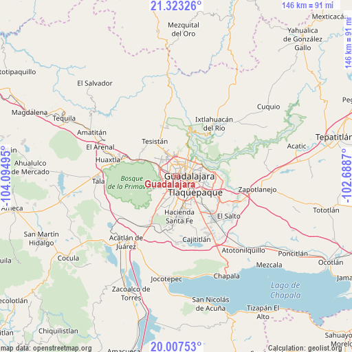
Guadalajara GPS coordinates[2]
20° 40' 0.552" North, 103° 23' 30.552" West
| Map corner | latitude | longitude |
|---|---|---|
| Upper-left | 21.32326°, | -104.09495° |
| Center: | 20.66682°, | -103.39182° |
| Lower-right: | 20.00753°, | -102.6887° |
| Map W x H: | 146.3×146.3 km | = 90.9×90.9mi |
| max Lat: | 32.7° ⇑28.8% North |
| Guadalajara: | 20.66682° |
| min Lat: | ⇓71.2% South 14.53588° |
| min Long | Guadalajara | max Long |
| -117.105° | -103.39182° | -86.73105° |
| W 12.3%⇐ | ⇒87.7% E |
Elevation
Elevation of Guadalajara is 1598 m = 5243 ft, and this is 344.3 m = 1130 ft above average elevation for this country.
| Max E: |
3497 m = 11473 ft | 44.7% |
| Guadalajara | 1598 m 5243 ft | |
| Avg. | 1253.7 m = 4113 ft | |
Min E: |
-1 m = -3 ft | 55.3% |
See also: Guadalajara elevation on elevation.city.
Geographical zone
Guadalajara is located in North Torrid zone (between Equator and Tropic of Cancer). Distance of this Northern Tropic circle is 308 km =191.4 mi to North.| Distance of | km | miles | from Guadalajara |
|---|---|---|---|
| North Pole | 7709.1 | 4790.2 | to North |
| Arctic Circle | 5103.2 | 3171 | to North |
| Tropic Cancer | 308 | 191.4 | to North |
| Equator | 2297.9 | 1427.8 | to South |


Nearby cities:
15 places around Guadalajara: (largest is in red/bold)
• Altus Bosques
11.2 km =7 mi,  169°
169°
• La Calerilla
11.4 km =7.1 mi,  189°
189°
• La Tijera
10.7 km =6.6 mi,  208°
208°
• Las Pintas de Arriba
12.6 km =7.8 mi,  145°
145°
• Los Gavilanes
11.8 km =7.3 mi, 210°
• Los Magueyes (Fraccionamiento el Sereno)
11.7 km =7.3 mi,  204°
204°
• Nuevo Israel
13.5 km =8.4 mi,  74°
74°
• Nuevo México
11.3 km =7 mi,  331°
331°
• Palomar
10.9 km =6.8 mi,  220°
220°
• Paseo del Prado
11.4 km =7.1 mi,  178°
178°
• Rancho Contento
10.3 km =6.4 mi,  299°
299°
• Santa Rosa (Real Tulipanes) [Fraccionamiento]
10.6 km =6.6 mi, 171°
• Tlaquepaque
10.7 km =6.6 mi,  105°
105°
• Zapopan
6.4 km =4 mi,  6°
6°
• Zapopan2
5.6 km =3.5 mi,  351°
351°
Sources, notices
• [Note1] Compared only with cities in Mexico existing in our database
• [Src1] Map data: © OpenStreetMap contributors (CC-BY-SA)
• [Src2] Other city data from geonames.org with taken over terms of usage.
• [Src3] Geographical zone / Annual Mean Temperature by Robert A. Rohde @ Wikipedia
