Nuevo Graseros geodata
Nuevo Graseros (Durango) is a populated place; located in Mexico in America/Monterrey (GMT-6) time zone. With population of 862 people, there are 10147 cities with bigger population in this country. Compared to other cities in Mexico, 92.1% of cities are located further ↓South; 89.2% of cities are located further →East and 54.9% of cities have higher elevation than Nuevo Graseros. Note1


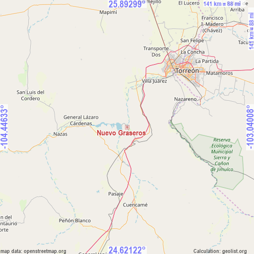
Nuevo Graseros GPS coordinates[2]
25° 15' 31.572" North, 103° 44' 35.52" West
| Map corner | latitude | longitude |
|---|---|---|
| Upper-left | 25.89299°, | -104.44633° |
| Center: | 25.25877°, | -103.7432° |
| Lower-right: | 24.62122°, | -103.04008° |
| Map W x H: | 141.4×141.4 km | = 87.9×87.9mi |
| max Lat: | 32.7° ⇑7.9% North |
| Nuevo Graseros: | 25.25877° |
| min Lat: | ⇓92.1% South 14.53588° |
| min Long | Nuevo Graseros | max Long |
| -117.105° | -103.7432° | -86.73105° |
| W 10.8%⇐ | ⇒89.2% E |
Elevation
Elevation of Nuevo Graseros is 1203 m = 3947 ft, and this is 50.7 m = 166 ft below average elevation for this country.
| Max E: |
3497 m = 11473 ft | 54.9% |
| Avg. | 1253.7 m = 4113 ft | |
| Nuevo Graseros | 1203 m = 3947 ft | |
Min E: |
-1 m = -3 ft | 45.1% |
See also: Mexico elevation on elevation.city.
Geographical zone
Nuevo Graseros is located in North temperate zone (between Tropic of Cancer and the Arctic Circle). Distance of this Northern Tropic circle is 202.6 km =125.9 mi to South.| Distance of | km | miles | from Nuevo Graseros |
|---|---|---|---|
| North Pole | 7198.5 | 4472.9 | to North |
| Arctic Circle | 4592.7 | 2853.8 | to North |
| Tropic Cancer | 202.6 | 125.9 | to South |
| Equator | 2808.5 | 1745.1 | to South |


Nearby cities:
15 places around Nuevo Graseros: (largest is in red/bold)
• Emilio Carranza
20.3 km =12.6 mi,  270°
270°
• General Lázaro Cárdenas
25.9 km =16.1 mi,  278°
278°
• Juan E. García
26.5 km =16.5 mi,  11°
11°
• La Goma
25.7 km =16 mi, 12°
• La Loma
23.9 km =14.9 mi,  17°
17°
• Las Mercedes
26.7 km =16.6 mi,  203°
203°
• Los Cuatillos
18.4 km =11.4 mi,  188°
188°
• Paso Nacional
27.8 km =17.3 mi, 270°
• Pedriceña
16.3 km =10.1 mi, 196°
• Picardías
26.9 km =16.7 mi,  74°
74°
• San Jacinto
24.6 km =15.3 mi,  1°
1°
• Santa Teresa de la Uña
24.2 km =15 mi, 271°
• Sapioris
21.7 km =13.5 mi, 7°
• Velardeña
21.6 km =13.4 mi,  178°
178°
• Ventana
27.7 km =17.2 mi, 74°
Sources, notices
• [Note1] Compared only with cities in Mexico existing in our database
• [Src1] Map data: © OpenStreetMap contributors (CC-BY-SA)
• [Src2] Other city data from geonames.org with taken over terms of usage.
• [Src3] Geographical zone / Annual Mean Temperature by Robert A. Rohde @ Wikipedia
