Graseros geodata
Graseros (Durango) is a populated place; located in Mexico in America/Monterrey (GMT-6) time zone. With population of 959 people, there are 9077 cities with bigger population in this country. Compared to other cities in Mexico, 89.3% of cities are located further ↓South; 90.1% of cities are located further →East and 68.9% of cities have lower elevation than Graseros. Note1


Graseros GPS coordinates[2]
23° 44' 24.432" North, 104° 2' 30.408" West
| Map corner | latitude | longitude |
|---|---|---|
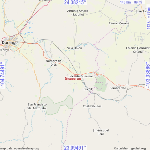
| Upper-left | 24.38215°, | -104.74491° |
| Center: | 23.74012°, | -104.04178° |
| Lower-right: | 23.09491°, | -103.33866° |
| Map W x H: | 143.1×143.1 km | = 88.9×88.9mi |
| max Lat: | 32.7° ⇑10.7% North |
| Graseros: | 23.74012° |
| min Lat: | ⇓89.3% South 14.53588° |
| min Long | Graseros | max Long |
| -117.105° | -104.04178° | -86.73105° |
| W 9.9%⇐ | ⇒90.1% E |
Elevation
Elevation of Graseros is 1905 m = 6250 ft, and this is 651.3 m = 2137 ft above average elevation for this country.
| Max E: |
3497 m = 11473 ft | 31.1% |
| Graseros | 1905 m 6250 ft | |
| Avg. | 1253.7 m = 4113 ft | |
Min E: |
-1 m = -3 ft | 68.9% |
See also: Mexico elevation on elevation.city.
Geographical zone
Graseros is located in North temperate zone (between Tropic of Cancer and the Arctic Circle). Distance of this Northern Tropic circle is 33.7 km =20.9 mi to South.| Distance of | km | miles | from Graseros |
|---|---|---|---|
| North Pole | 7367.4 | 4577.9 | to North |
| Arctic Circle | 4761.5 | 2958.7 | to North |
| Tropic Cancer | 33.7 | 20.9 | to South |
| Equator | 2639.7 | 1640.2 | to South |


Nearby cities:
15 places around Graseros: (largest is in red/bold)
• Amado Nervo
18.7 km =11.6 mi,  308°
308°
• Damián Carmona
24.1 km =15 mi,  337°
337°
• El Potosí
23.9 km =14.9 mi,  345°
345°
• Gabriel Hernández (Mancinas)
8.1 km =5 mi,  12°
12°
• La Joya
11.7 km =7.3 mi,  22°
22°
• Los Ángeles
24.4 km =15.2 mi, 338°
• Nombre de Dios
24.1 km =15 mi,  300°
300°
• Orizaba
24.4 km =15.2 mi, 352°
• Rojas
12.8 km =8 mi, 353°
• San Francisco Javier
1.8 km =1.1 mi,  152°
152°
• San Isidro de Murillos
7.9 km =4.9 mi,  183°
183°
• Santa Cruz de Guadalupe
18.6 km =11.6 mi, 311°
• Súchil
17.8 km =11.1 mi,  137°
137°
• Vicente Guerrero
5.8 km =3.6 mi,  96°
96°
• Villa Insurgentes (El Calabazal)
20.3 km =12.6 mi,  89°
89°
Sources, notices
• [Note1] Compared only with cities in Mexico existing in our database
• [Src1] Map data: © OpenStreetMap contributors (CC-BY-SA)
• [Src2] Other city data from geonames.org with taken over terms of usage.
• [Src3] Geographical zone / Annual Mean Temperature by Robert A. Rohde @ Wikipedia
