Santa Cruz de Guadalupe geodata
Santa Cruz de Guadalupe (Durango) is a populated place; located in Mexico in America/Monterrey (GMT-6) time zone. With population of 970 people, there are 8961 cities with bigger population in this country. Compared to other cities in Mexico, 89.6% of cities are located further ↓South; 90.4% of cities are located further →East and 65.3% of cities have lower elevation than Santa Cruz de Guadalupe. Note1
Current local time in Santa Cruz de Guadalupe:
09:05 AM, MondayDifference from your time zone: hours


Santa Cruz de Guadalupe GPS coordinates[2]
23° 51' 6.012" North, 104° 10' 41.016" West
| Map corner | latitude | longitude |
|---|---|---|
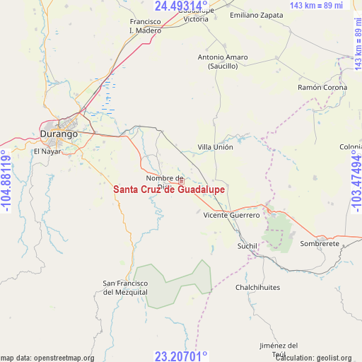
| Upper-left | 24.49314°, | -104.88119° |
| Center: | 23.85167°, | -104.17806° |
| Lower-right: | 23.20701°, | -103.47494° |
| Map W x H: | 143×143 km | = 88.9×88.9mi |
| max Lat: | 32.7° ⇑10.4% North |
| Santa Cruz de Guadalupe: | 23.85167° |
| min Lat: | ⇓89.6% South 14.53588° |
| min Long | Santa Cruz de G | max Long |
| -117.105° | -104.17806° | -86.73105° |
| W 9.6%⇐ | ⇒90.4% E |
Elevation
Elevation of Santa Cruz de Guadalupe is 1838 m = 6030 ft, and this is 584.3 m = 1917 ft above average elevation for this country.
| Max E: |
3497 m = 11473 ft | 34.7% |
| Santa Cruz de Guadalupe | 1838 m 6030 ft | |
| Avg. | 1253.7 m = 4113 ft | |
Min E: |
-1 m = -3 ft | 65.3% |
See also: Mexico elevation on elevation.city.
Geographical zone
Santa Cruz de Guadalupe is located in North temperate zone (between Tropic of Cancer and the Arctic Circle). Distance of this Northern Tropic circle is 46.1 km =28.6 mi to South.| Distance of | km | miles | from Santa Cruz de Guadalupe |
|---|---|---|---|
| North Pole | 7355 | 4570.2 | to North |
| Arctic Circle | 4749.1 | 2951 | to North |
| Tropic Cancer | 46.1 | 28.6 | to South |
| Equator | 2652.1 | 1647.9 | to South |


Nearby cities:
15 places around Santa Cruz de Guadalupe: (largest is in red/bold)
• Amado Nervo
1.1 km =0.7 mi,  224°
224°
• Damián Carmona
11 km =6.8 mi,  25°
25°
• El Potosí
13.2 km =8.2 mi,  35°
35°
• Gabriel Hernández (Mancinas)
16.2 km =10.1 mi,  105°
105°
• Graseros
18.6 km =11.6 mi,  131°
131°
• La Constancia
11.4 km =7.1 mi,  308°
308°
• La Joya
18.3 km =11.4 mi,  94°
94°
• Los Ángeles
11.2 km =7 mi, 25°
• Nombre de Dios
7 km =4.3 mi,  267°
267°
• Orizaba
15.8 km =9.8 mi, 41°
• Rojas
12.5 km =7.8 mi, 88°
• San Atenógenes (La Villita)
22.5 km =14 mi,  46°
46°
• San Francisco Javier
20.3 km =12.6 mi, 133°
• Tuitán
21.2 km =13.2 mi,  339°
339°
• Villa Unión
19.1 km =11.9 mi, 44°
Sources, notices
• [Note1] Compared only with cities in Mexico existing in our database
• [Src1] Map data: © OpenStreetMap contributors (CC-BY-SA)
• [Src2] Other city data from geonames.org with taken over terms of usage.
• [Src3] Geographical zone / Annual Mean Temperature by Robert A. Rohde @ Wikipedia
