Rojas geodata
Rojas (Durango) is a populated place; located in Mexico in America/Monterrey (GMT-6) time zone. With population of 741 people, there are 11804 cities with bigger population in this country. Compared to other cities in Mexico, 89.6% of cities are located further ↓South; 90.1% of cities are located further →East and 67.4% of cities have lower elevation than Rojas. Note1


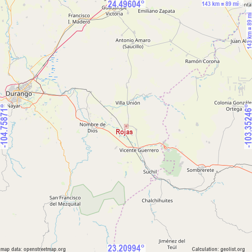
Rojas GPS coordinates[2]
23° 51' 16.524" North, 104° 3' 20.088" West
| Map corner | latitude | longitude |
|---|---|---|
| Upper-left | 24.49604°, | -104.75871° |
| Center: | 23.85459°, | -104.05558° |
| Lower-right: | 23.20994°, | -103.35246° |
| Map W x H: | 143×143 km | = 88.9×88.9mi |
| max Lat: | 32.7° ⇑10.4% North |
| Rojas: | 23.85459° |
| min Lat: | ⇓89.6% South 14.53588° |
| min Long | Rojas | max Long |
| -117.105° | -104.05558° | -86.73105° |
| W 9.9%⇐ | ⇒90.1% E |
Elevation
Elevation of Rojas is 1877 m = 6158 ft, and this is 623.3 m = 2045 ft above average elevation for this country.
| Max E: |
3497 m = 11473 ft | 32.6% |
| Rojas | 1877 m 6158 ft | |
| Avg. | 1253.7 m = 4113 ft | |
Min E: |
-1 m = -3 ft | 67.4% |
See also: Mexico elevation on elevation.city.
Geographical zone
Rojas is located in North temperate zone (between Tropic of Cancer and the Arctic Circle). Distance of this Northern Tropic circle is 46.5 km =28.9 mi to South.| Distance of | km | miles | from Rojas |
|---|---|---|---|
| North Pole | 7354.7 | 4570 | to North |
| Arctic Circle | 4748.8 | 2950.8 | to North |
| Tropic Cancer | 46.5 | 28.9 | to South |
| Equator | 2652.4 | 1648.1 | to South |


Nearby cities:
15 places around Rojas: (largest is in red/bold)
• Amado Nervo
13.3 km =8.3 mi,  265°
265°
• Damián Carmona
12.3 km =7.6 mi,  321°
321°
• El Potosí
11.4 km =7.1 mi,  335°
335°
• Gabriel Hernández (Mancinas)
5.7 km =3.5 mi,  146°
146°
• Graseros
12.8 km =8 mi,  173°
173°
• La Joya
6.1 km =3.8 mi,  108°
108°
• Los Ángeles
12.5 km =7.8 mi, 322°
• Narciso Mendoza
19.8 km =12.3 mi,  27°
27°
• Nombre de Dios
19.5 km =12.1 mi, 268°
• Orizaba
11.6 km =7.2 mi,  350°
350°
• San Atenógenes (La Villita)
15.6 km =9.7 mi,  14°
14°
• San Francisco Javier
14.5 km =9 mi, 171°
• Santa Cruz de Guadalupe
12.5 km =7.8 mi, 268°
• Vicente Guerrero
15.2 km =9.4 mi, 151°
• Villa Unión
13.4 km =8.3 mi,  3°
3°
Sources, notices
• [Note1] Compared only with cities in Mexico existing in our database
• [Src1] Map data: © OpenStreetMap contributors (CC-BY-SA)
• [Src2] Other city data from geonames.org with taken over terms of usage.
• [Src3] Geographical zone / Annual Mean Temperature by Robert A. Rohde @ Wikipedia
