Etúcuaro geodata
Etúcuaro (State of Mexico) is a populated place; located in Mexico in America/Mexico_City (GMT-6) time zone. With population of 1,263 people, there are 6854 cities with bigger population in this country. Compared to other cities in Mexico, 54.9% of cities are located further ↓South; 81.7% of cities are located further →East and 60.4% of cities have lower elevation than Etúcuaro. Note1


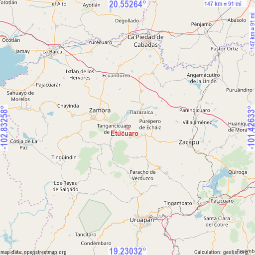
Etúcuaro GPS coordinates[2]
19° 53' 34.296" North, 102° 7' 46.02" West
| Map corner | latitude | longitude |
|---|---|---|
| Upper-left | 20.55264°, | -102.83258° |
| Center: | 19.89286°, | -102.12945° |
| Lower-right: | 19.23032°, | -101.42633° |
| Map W x H: | 147×147 km | = 91.3×91.3mi |
| max Lat: | 32.7° ⇑45.1% North |
| Etúcuaro: | 19.89286° |
| min Lat: | ⇓54.9% South 14.53588° |
| min Long | Etúcuaro | max Long |
| -117.105° | -102.12945° | -86.73105° |
| W 18.3%⇐ | ⇒81.7% E |
Elevation
Elevation of Etúcuaro is 1731 m = 5679 ft, and this is 477.3 m = 1566 ft above average elevation for this country.
| Max E: |
3497 m = 11473 ft | 39.6% |
| Etúcuaro | 1731 m 5679 ft | |
| Avg. | 1253.7 m = 4113 ft | |
Min E: |
-1 m = -3 ft | 60.4% |
See also: Mexico elevation on elevation.city.
Geographical zone
Etúcuaro is located in North Torrid zone (between Equator and Tropic of Cancer). Distance of this Northern Tropic circle is 394 km =244.8 mi to North.| Distance of | km | miles | from Etúcuaro |
|---|---|---|---|
| North Pole | 7795.2 | 4843.7 | to North |
| Arctic Circle | 5189.3 | 3224.5 | to North |
| Tropic Cancer | 394 | 244.8 | to North |
| Equator | 2211.9 | 1374.4 | to South |


Nearby cities:
15 places around Etúcuaro: (largest is in red/bold)
• Acachuén
6.4 km =4 mi,  142°
142°
• Chilchota
5.3 km =3.3 mi,  165°
165°
• Colonia las Malvinas (Colonia Antorcha)
10.2 km =6.3 mi,  260°
260°
• Gómez Farías
4.3 km =2.7 mi,  318°
318°
• Huancito
8.1 km =5 mi,  127°
127°
• Ichán
8.8 km =5.5 mi,  116°
116°
• Los Nogales
4.8 km =3 mi,  215°
215°
• Santo Tomás
7 km =4.3 mi, 139°
• Tacuro (Santa María Tacuro)
9.1 km =5.7 mi, 115°
• Tanaquillo
6.2 km =3.9 mi,  147°
147°
• Tangancícuaro de Arista
8.1 km =5 mi,  265°
265°
• Tierras Blancas
6.9 km =4.3 mi,  331°
331°
• Urén
5.8 km =3.6 mi, 154°
• Valle de Guadalupe
2.1 km =1.3 mi,  340°
340°
• Zopoco
8.2 km =5.1 mi, 135°
Sources, notices
• [Note1] Compared only with cities in Mexico existing in our database
• [Src1] Map data: © OpenStreetMap contributors (CC-BY-SA)
• [Src2] Other city data from geonames.org with taken over terms of usage.
• [Src3] Geographical zone / Annual Mean Temperature by Robert A. Rohde @ Wikipedia
