Francisco Villa geodata
Francisco Villa (Jalisco) is a populated place; located in Mexico in America/Mexico_City (GMT-6) time zone. With population of 898 people, there are 9712 cities with bigger population in this country. Compared to other cities in Mexico, 56.6% of cities are located further ↑North; 91.9% of cities are located further →East and 94.6% of cities have higher elevation than Francisco Villa. Note1


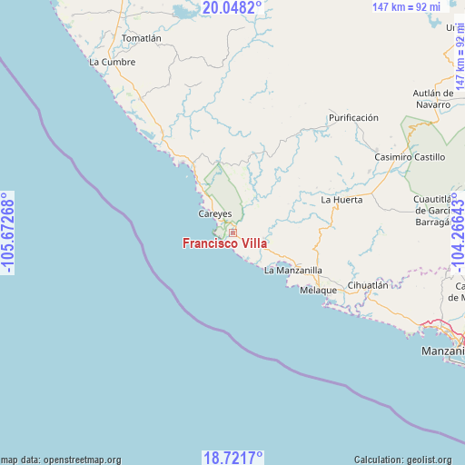
Francisco Villa GPS coordinates[2]
19° 23' 10.68" North, 104° 58' 10.38" West
| Map corner | latitude | longitude |
|---|---|---|
| Upper-left | 20.0482°, | -105.67268° |
| Center: | 19.3863°, | -104.96955° |
| Lower-right: | 18.7217°, | -104.26643° |
| Map W x H: | 147.5×147.5 km | = 91.7×91.7mi |
| max Lat: | 32.7° ⇑56.6% North |
| Francisco Villa: | 19.3863° |
| min Lat: | ⇓43.4% South 14.53588° |
| min Long | Francisco Villa | max Long |
| -117.105° | -104.96955° | -86.73105° |
| W 8.1%⇐ | ⇒91.9% E |
Elevation
Elevation of Francisco Villa is 14 m = 46 ft, and this is 1239.7 m = 4067 ft below average elevation for this country.
| Max E: |
3497 m = 11473 ft | 94.6% |
| Avg. | 1253.7 m = 4113 ft | |
| Francisco Villa | 14 m = 46 ft | |
Min E: |
-1 m = -3 ft | 5.4% |
See also: Mexico elevation on elevation.city.
Geographical zone
Francisco Villa is located in North Torrid zone (between Equator and Tropic of Cancer). Distance of this Northern Tropic circle is 450.4 km =279.9 mi to North.| Distance of | km | miles | from Francisco Villa |
|---|---|---|---|
| North Pole | 7851.5 | 4878.7 | to North |
| Arctic Circle | 5245.6 | 3259.5 | to North |
| Tropic Cancer | 450.4 | 279.9 | to North |
| Equator | 2155.6 | 1339.4 | to South |


Nearby cities:
15 places around Francisco Villa: (largest is in red/bold)
• Apazulco (Miguel Hidalgo Viejo)
9.7 km =6 mi,  100°
100°
• Barra de Navidad
36.1 km =22.4 mi,  123°
123°
• Colonia Pinal Villa
33.3 km =20.7 mi, 119°
• El Aguacate
38.6 km =24 mi, 117°
• El Rebalsito de Apazulco
12.5 km =7.8 mi,  135°
135°
• Emiliano Zapata
0.5 km =0.3 mi,  94°
94°
• Emiliano Zapata (El Ranchito)
30.7 km =19.1 mi, 121°
• Jaluco
34.6 km =21.5 mi, 120°
• José María Morelos
39.5 km =24.5 mi,  325°
325°
• La Huerta
35.9 km =22.3 mi,  72°
72°
• La Manzanilla
22.4 km =13.9 mi, 121°
• Las Juntas
28 km =17.4 mi,  79°
79°
• Perula
28.1 km =17.5 mi,  323°
323°
• San Mateo
24.6 km =15.3 mi, 330°
• San Patricio
33.1 km =20.6 mi, 122°
Sources, notices
• [Note1] Compared only with cities in Mexico existing in our database
• [Src1] Map data: © OpenStreetMap contributors (CC-BY-SA)
• [Src2] Other city data from geonames.org with taken over terms of usage.
• [Src3] Geographical zone / Annual Mean Temperature by Robert A. Rohde @ Wikipedia
