Perula geodata
Perula (Jalisco) is a populated place; located in Mexico in America/Mexico_City (GMT-6) time zone. With population of 793 people, there are 11002 cities with bigger population in this country. Compared to other cities in Mexico, 52.1% of cities are located further ↑North; 92.1% of cities are located further →East and 97.5% of cities have higher elevation than Perula. Note1


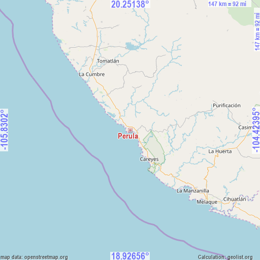
Perula GPS coordinates[2]
19° 35' 25.188" North, 105° 7' 37.452" West
| Map corner | latitude | longitude |
|---|---|---|
| Upper-left | 20.25138°, | -105.8302° |
| Center: | 19.59033°, | -105.12707° |
| Lower-right: | 18.92656°, | -104.42395° |
| Map W x H: | 147.3×147.3 km | = 91.5×91.5mi |
| max Lat: | 32.7° ⇑52.1% North |
| Perula: | 19.59033° |
| min Lat: | ⇓47.9% South 14.53588° |
| min Long | Perula | max Long |
| -117.105° | -105.12707° | -86.73105° |
| W 7.9%⇐ | ⇒92.1% E |
Elevation
Elevation of Perula is 9 m = 30 ft, and this is 1244.7 m = 4084 ft below average elevation for this country.
| Max E: |
3497 m = 11473 ft | 97.5% |
| Avg. | 1253.7 m = 4113 ft | |
| Perula | 9 m = 30 ft | |
Min E: |
-1 m = -3 ft | 2.5% |
See also: Mexico elevation on elevation.city.
Geographical zone
Perula is located in North Torrid zone (between Equator and Tropic of Cancer). Distance of this Northern Tropic circle is 427.7 km =265.8 mi to North.| Distance of | km | miles | from Perula |
|---|---|---|---|
| North Pole | 7828.8 | 4864.6 | to North |
| Arctic Circle | 5222.9 | 3245.4 | to North |
| Tropic Cancer | 427.7 | 265.8 | to North |
| Equator | 2178.2 | 1353.5 | to South |


Nearby cities:
15 places around Perula: (largest is in red/bold)
• Apazulco (Miguel Hidalgo Viejo)
35.8 km =22.2 mi,  133°
133°
• Campo Acosta
23.8 km =14.8 mi,  327°
327°
• El Rebalsito de Apazulco
40.5 km =25.2 mi,  141°
141°
• Emiliano Zapata
28.4 km =17.6 mi, 143°
• Francisco Villa
28.1 km =17.5 mi, 143°
• José María Morelos
11.5 km =7.1 mi, 328°
• José María Pino Suárez (Nuevo Nahuapa)
45.1 km =28 mi, 332°
• La Cumbre
38.4 km =23.9 mi, 325°
• La Gloria
46.7 km =29 mi, 326°
• La Manzanilla
49.5 km =30.8 mi, 133°
• Las Juntas
47.5 km =29.5 mi,  111°
111°
• Lázaro Cárdenas
26.7 km =16.6 mi,  352°
352°
• San Mateo
4.5 km =2.8 mi, 107°
• San Miguel
43 km =26.7 mi,  76°
76°
• Tomatlán
40.6 km =25.2 mi,  341°
341°
Sources, notices
• [Note1] Compared only with cities in Mexico existing in our database
• [Src1] Map data: © OpenStreetMap contributors (CC-BY-SA)
• [Src2] Other city data from geonames.org with taken over terms of usage.
• [Src3] Geographical zone / Annual Mean Temperature by Robert A. Rohde @ Wikipedia
