La Esperanza geodata
La Esperanza (Guanajuato) is a populated place; located in Mexico in America/Mexico_City (GMT-6) time zone. With population of 616 people, there are 13995 cities with bigger population in this country. Compared to other cities in Mexico, 61.7% of cities are located further ↓South; 71.3% of cities are located further →East and 71% of cities have lower elevation than La Esperanza. Note1


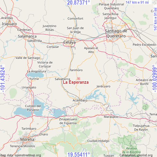
La Esperanza GPS coordinates[2]
20° 12' 55.116" North, 100° 43' 59.196" West
| Map corner | latitude | longitude |
|---|---|---|
| Upper-left | 20.87371°, | -101.43624° |
| Center: | 20.21531°, | -100.73311° |
| Lower-right: | 19.55411°, | -100.02999° |
| Map W x H: | 146.7×146.7 km | = 91.2×91.2mi |
| max Lat: | 32.7° ⇑38.3% North |
| La Esperanza: | 20.21531° |
| min Lat: | ⇓61.7% South 14.53588° |
| min Long | La Esperanza | max Long |
| -117.105° | -100.73311° | -86.73105° |
| W 28.7%⇐ | ⇒71.3% E |
Elevation
Elevation of La Esperanza is 1945 m = 6381 ft, and this is 691.3 m = 2268 ft above average elevation for this country.
| Max E: |
3497 m = 11473 ft | 29% |
| La Esperanza | 1945 m 6381 ft | |
| Avg. | 1253.7 m = 4113 ft | |
Min E: |
-1 m = -3 ft | 71% |
See also: Mexico elevation on elevation.city.
Geographical zone
La Esperanza is located in North Torrid zone (between Equator and Tropic of Cancer). Distance of this Northern Tropic circle is 358.2 km =222.6 mi to North.| Distance of | km | miles | from La Esperanza |
|---|---|---|---|
| North Pole | 7759.3 | 4821.4 | to North |
| Arctic Circle | 5153.4 | 3202.2 | to North |
| Tropic Cancer | 358.2 | 222.6 | to North |
| Equator | 2247.7 | 1396.7 | to South |


Nearby cities:
15 places around La Esperanza: (largest is in red/bold)
• Charco Largo
10.4 km =6.5 mi,  307°
307°
• El Acebuche
1.3 km =0.8 mi, 313°
• El Maguey
13.5 km =8.4 mi,  158°
158°
• Galerade Panales
12.2 km =7.6 mi,  316°
316°
• Gaytán del Refugio
10.1 km =6.3 mi,  137°
137°
• Jaral del Refugio
11.2 km =7 mi,  174°
174°
• La Concepción
4.3 km =2.7 mi,  189°
189°
• La Moncada
10.7 km =6.6 mi, 315°
• Los Fierros
3.7 km =2.3 mi,  228°
228°
• Ojo de Agua de Ballesteros
9.6 km =6 mi,  278°
278°
• Panales Jamaica (Cañones)
12.9 km =8 mi, 313°
• Parácuaro
8.6 km =5.3 mi,  201°
201°
• San Nicolás de la Condesa
5.4 km =3.4 mi,  291°
291°
• Tarimoro
7.9 km =4.9 mi,  343°
343°
• Urireo
11.4 km =7.1 mi,  268°
268°
Sources, notices
• [Note1] Compared only with cities in Mexico existing in our database
• [Src1] Map data: © OpenStreetMap contributors (CC-BY-SA)
• [Src2] Other city data from geonames.org with taken over terms of usage.
• [Src3] Geographical zone / Annual Mean Temperature by Robert A. Rohde @ Wikipedia
