Gaytán del Refugio geodata
Gaytán del Refugio (Guanajuato) is a populated place; located in Mexico in America/Mexico_City (GMT-6) time zone. With population of 501 people, there are 16785 cities with bigger population in this country. Compared to other cities in Mexico, 60.2% of cities are located further ↓South; 70.8% of cities are located further →East and 72.5% of cities have lower elevation than Gaytán del Refugio. Note1


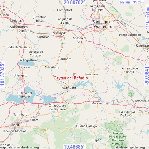
Gaytán del Refugio GPS coordinates[2]
20° 8' 53.988" North, 100° 40' 1.992" West
| Map corner | latitude | longitude |
|---|---|---|
| Upper-left | 20.80702°, | -101.37035° |
| Center: | 20.14833°, | -100.66722° |
| Lower-right: | 19.48685°, | -99.9641° |
| Map W x H: | 146.8×146.8 km | = 91.2×91.2mi |
| max Lat: | 32.7° ⇑39.8% North |
| Gaytán del Refugio: | 20.14833° |
| min Lat: | ⇓60.2% South 14.53588° |
| min Long | Gaytán del Ref | max Long |
| -117.105° | -100.66722° | -86.73105° |
| W 29.2%⇐ | ⇒70.8% E |
Elevation
Elevation of Gaytán del Refugio is 1978 m = 6490 ft, and this is 724.3 m = 2376 ft above average elevation for this country.
| Max E: |
3497 m = 11473 ft | 27.5% |
| Gaytán del Refugio | 1978 m 6490 ft | |
| Avg. | 1253.7 m = 4113 ft | |
Min E: |
-1 m = -3 ft | 72.5% |
See also: Mexico elevation on elevation.city.
Geographical zone
Gaytán del Refugio is located in North Torrid zone (between Equator and Tropic of Cancer). Distance of this Northern Tropic circle is 365.6 km =227.2 mi to North.| Distance of | km | miles | from Gaytán del Refugio |
|---|---|---|---|
| North Pole | 7766.8 | 4826.1 | to North |
| Arctic Circle | 5160.9 | 3206.8 | to North |
| Tropic Cancer | 365.6 | 227.2 | to North |
| Equator | 2240.3 | 1392.1 | to South |


Nearby cities:
15 places around Gaytán del Refugio: (largest is in red/bold)
• Agua Caliente
12.1 km =7.5 mi,  183°
183°
• El Acebuche
11.4 km =7.1 mi,  316°
316°
• El Maguey
5.5 km =3.4 mi,  201°
201°
• El Terrero
9.8 km =6.1 mi,  96°
96°
• Jaral del Refugio
6.8 km =4.2 mi,  237°
237°
• La Concepción
8.2 km =5.1 mi,  293°
293°
• La Encarnación
9 km =5.6 mi,  158°
158°
• La Esperanza
10.1 km =6.3 mi, 317°
• Los Fierros
10.9 km =6.8 mi,  297°
297°
• Ojo de Agua de Mendoza
10.4 km =6.5 mi,  79°
79°
• Parácuaro
10.1 km =6.3 mi,  267°
267°
• San Cayetano
7.7 km =4.8 mi,  173°
173°
• San Juan Viejo
10.5 km =6.5 mi,  234°
234°
• Santiaguillo
4.9 km =3 mi,  149°
149°
• Solís
10.9 km =6.8 mi,  186°
186°
Sources, notices
• [Note1] Compared only with cities in Mexico existing in our database
• [Src1] Map data: © OpenStreetMap contributors (CC-BY-SA)
• [Src2] Other city data from geonames.org with taken over terms of usage.
• [Src3] Geographical zone / Annual Mean Temperature by Robert A. Rohde @ Wikipedia
