El Capomo geodata
El Capomo (Nayarit) is a populated place; located in Mexico in America/Mazatlan (GMT-7) time zone. With population of 999 people, there are 8726 cities with bigger population in this country. Compared to other cities in Mexico, 78.1% of cities are located further ↓South; 92.1% of cities are located further →East and 81.8% of cities have higher elevation than El Capomo. Note1


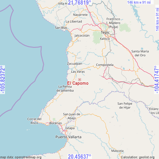
El Capomo GPS coordinates[2]
21° 6' 49.428" North, 105° 7' 14.124" West
| Map corner | latitude | longitude |
|---|---|---|
| Upper-left | 21.76819°, | -105.82372° |
| Center: | 21.11373°, | -105.12059° |
| Lower-right: | 20.45637°, | -104.41747° |
| Map W x H: | 145.9×145.9 km | = 90.7×90.7mi |
| max Lat: | 32.7° ⇑21.9% North |
| El Capomo: | 21.11373° |
| min Lat: | ⇓78.1% South 14.53588° |
| min Long | El Capomo | max Long |
| -117.105° | -105.12059° | -86.73105° |
| W 7.9%⇐ | ⇒92.1% E |
Elevation
Elevation of El Capomo is 72 m = 236 ft, and this is 1181.7 m = 3877 ft below average elevation for this country.
| Max E: |
3497 m = 11473 ft | 81.8% |
| Avg. | 1253.7 m = 4113 ft | |
| El Capomo | 72 m = 236 ft | |
Min E: |
-1 m = -3 ft | 18.2% |
See also: Mexico elevation on elevation.city.
Geographical zone
El Capomo is located in North Torrid zone (between Equator and Tropic of Cancer). Distance of this Northern Tropic circle is 258.3 km =160.5 mi to North.| Distance of | km | miles | from El Capomo |
|---|---|---|---|
| North Pole | 7659.4 | 4759.3 | to North |
| Arctic Circle | 5053.5 | 3140.1 | to North |
| Tropic Cancer | 258.3 | 160.5 | to North |
| Equator | 2347.6 | 1458.7 | to South |


Nearby cities:
15 places around El Capomo: (largest is in red/bold)
• Aguamilpa
23.4 km =14.5 mi,  156°
156°
• Colonia Paraíso Escondido
13.9 km =8.6 mi,  241°
241°
• Compostela
26.7 km =16.6 mi,  58°
58°
• El Paranal (Arocha)
18.4 km =11.4 mi,  12°
12°
• Ixtapan de la Concepción
21.9 km =13.6 mi,  349°
349°
• La Peñita de Jaltomba
15.6 km =9.7 mi, 237°
• La Puerta de la Lima
6.7 km =4.2 mi,  253°
253°
• Las Piedras
10.1 km =6.3 mi,  15°
15°
• Las Varas
7.6 km =4.7 mi, 347°
• Lima de Abajo
8.1 km =5 mi,  260°
260°
• Mazatán
18.3 km =11.4 mi,  77°
77°
• Monteón
23.1 km =14.4 mi,  233°
233°
• Otates y Cantarranas
25.1 km =15.6 mi, 345°
• Rincón de Guayabitos
18.5 km =11.5 mi, 237°
• Zacualpan
15.6 km =9.7 mi,  342°
342°
Sources, notices
• [Note1] Compared only with cities in Mexico existing in our database
• [Src1] Map data: © OpenStreetMap contributors (CC-BY-SA)
• [Src2] Other city data from geonames.org with taken over terms of usage.
• [Src3] Geographical zone / Annual Mean Temperature by Robert A. Rohde @ Wikipedia
