Donato Guerra geodata
Donato Guerra (Durango) is a populated place; located in Mexico in America/Monterrey (GMT-6) time zone. With population of 769 people, there are 11375 cities with bigger population in this country. Compared to other cities in Mexico, 91.1% of cities are located further ↓South; 91.3% of cities are located further →East and 72.5% of cities have lower elevation than Donato Guerra. Note1


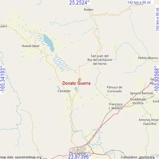
Donato Guerra GPS coordinates[2]
24° 36' 53.316" North, 104° 38' 19.68" West
| Map corner | latitude | longitude |
|---|---|---|
| Upper-left | 25.2524°, | -105.34193° |
| Center: | 24.61481°, | -104.6388° |
| Lower-right: | 23.97396°, | -103.93568° |
| Map W x H: | 142.1×142.2 km | = 88.3×88.4mi |
| max Lat: | 32.7° ⇑8.9% North |
| Donato Guerra: | 24.61481° |
| min Lat: | ⇓91.1% South 14.53588° |
| min Long | Donato Guerra | max Long |
| -117.105° | -104.6388° | -86.73105° |
| W 8.7%⇐ | ⇒91.3% E |
Elevation
Elevation of Donato Guerra is 1978 m = 6490 ft, and this is 724.3 m = 2376 ft above average elevation for this country.
| Max E: |
3497 m = 11473 ft | 27.5% |
| Donato Guerra | 1978 m 6490 ft | |
| Avg. | 1253.7 m = 4113 ft | |
Min E: |
-1 m = -3 ft | 72.5% |
See also: Mexico elevation on elevation.city.
Geographical zone
Donato Guerra is located in North temperate zone (between Tropic of Cancer and the Arctic Circle). Distance of this Northern Tropic circle is 131 km =81.4 mi to South.| Distance of | km | miles | from Donato Guerra |
|---|---|---|---|
| North Pole | 7270.2 | 4517.5 | to North |
| Arctic Circle | 4664.3 | 2898.3 | to North |
| Tropic Cancer | 131 | 81.4 | to South |
| Equator | 2736.9 | 1700.6 | to South |


Nearby cities:
15 places around Donato Guerra: (largest is in red/bold)
• Adolfo López Mateos (Aguinaldo)
17.1 km =10.6 mi,  117°
117°
• Bruno Martínez
10.7 km =6.6 mi,  186°
186°
• Canatlán
16.8 km =10.4 mi,  233°
233°
• Ciénega Grande
19.4 km =12.1 mi,  33°
33°
• Colonia Anáhuac (Palo Blanco)
22.9 km =14.2 mi,  172°
172°
• Diez de Octubre
12.6 km =7.8 mi,  1°
1°
• El Progreso
20.3 km =12.6 mi,  277°
277°
• General Martín López
20.6 km =12.8 mi,  213°
213°
• José Guadalupe Aguilera (Santa Lucía)
19.2 km =11.9 mi,  201°
201°
• La Sauceda
15.1 km =9.4 mi, 227°
• Nicolás Bravo
27.1 km =16.8 mi, 203°
• Ricardo Flores Magón
20.2 km =12.6 mi,  147°
147°
• San José de Gracia
18.7 km =11.6 mi, 213°
• San Juan del Rio del Centauro del Norte
25.7 km =16 mi,  45°
45°
• Venustiano Carranza
16 km =9.9 mi,  175°
175°
Sources, notices
• [Note1] Compared only with cities in Mexico existing in our database
• [Src1] Map data: © OpenStreetMap contributors (CC-BY-SA)
• [Src2] Other city data from geonames.org with taken over terms of usage.
• [Src3] Geographical zone / Annual Mean Temperature by Robert A. Rohde @ Wikipedia
