General Martín López geodata
General Martín López (Durango) is a populated place; located in Mexico in America/Monterrey (GMT-6) time zone. With population of 892 people, there are 9779 cities with bigger population in this country. Compared to other cities in Mexico, 90.8% of cities are located further ↓South; 91.5% of cities are located further →East and 70.6% of cities have lower elevation than General Martín López. Note1
Current local time in General Martín López:
06:46 AM, WednesdayDifference from your time zone: hours


General Martín López GPS coordinates[2]
24° 27' 35.64" North, 104° 45' 1.368" West
| Map corner | latitude | longitude |
|---|---|---|
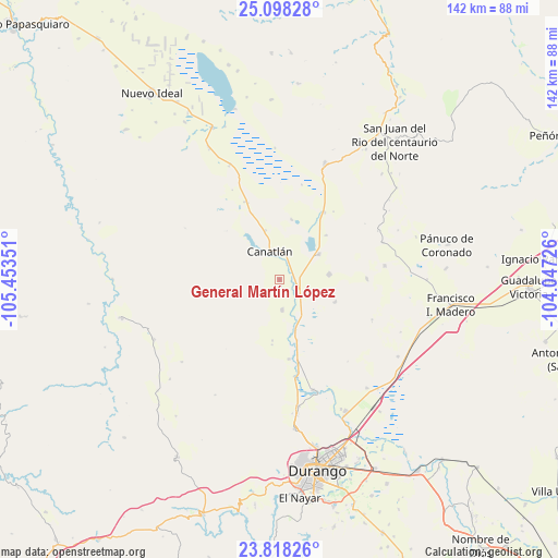
| Upper-left | 25.09828°, | -105.45351° |
| Center: | 24.4599°, | -104.75038° |
| Lower-right: | 23.81826°, | -104.04726° |
| Map W x H: | 142.3×142.3 km | = 88.4×88.4mi |
| max Lat: | 32.7° ⇑9.2% North |
| General Martín López: | 24.4599° |
| min Lat: | ⇓90.8% South 14.53588° |
| min Long | General Martín | max Long |
| -117.105° | -104.75038° | -86.73105° |
| W 8.5%⇐ | ⇒91.5% E |
Elevation
Elevation of General Martín López is 1937 m = 6355 ft, and this is 683.3 m = 2242 ft above average elevation for this country.
| Max E: |
3497 m = 11473 ft | 29.4% |
| General Martín López | 1937 m 6355 ft | |
| Avg. | 1253.7 m = 4113 ft | |
Min E: |
-1 m = -3 ft | 70.6% |
See also: Mexico elevation on elevation.city.
Geographical zone
General Martín López is located in North temperate zone (between Tropic of Cancer and the Arctic Circle). Distance of this Northern Tropic circle is 113.8 km =70.7 mi to South.| Distance of | km | miles | from General Martín López |
|---|---|---|---|
| North Pole | 7287.4 | 4528.2 | to North |
| Arctic Circle | 4681.5 | 2908.9 | to North |
| Tropic Cancer | 113.8 | 70.7 | to South |
| Equator | 2719.7 | 1689.9 | to South |


Nearby cities:
15 places around General Martín López: (largest is in red/bold)
• Adolfo López Mateos (Aguinaldo)
28.1 km =17.5 mi,  70°
70°
• Bruno Martínez
12 km =7.5 mi,  56°
56°
• Canatlán
7.7 km =4.8 mi,  342°
342°
• Colonia Anáhuac (Palo Blanco)
15.2 km =9.4 mi,  111°
111°
• Diez de Octubre
32 km =19.9 mi,  21°
21°
• Donato Guerra
20.6 km =12.8 mi,  33°
33°
• El Progreso
21.8 km =13.5 mi, 336°
• José Guadalupe Aguilera (Santa Lucía)
4.2 km =2.6 mi,  98°
98°
• Juan B. Ceballos
29.4 km =18.3 mi,  163°
163°
• La Sauceda
7.1 km =4.4 mi,  1°
1°
• Morcillo
32.6 km =20.3 mi,  171°
171°
• Nicolás Bravo
7.8 km =4.8 mi,  175°
175°
• Ricardo Flores Magón
22.3 km =13.9 mi,  89°
89°
• San José de Gracia
1.9 km =1.2 mi, 26°
• Venustiano Carranza
12.6 km =7.8 mi,  84°
84°
Sources, notices
• [Note1] Compared only with cities in Mexico existing in our database
• [Src1] Map data: © OpenStreetMap contributors (CC-BY-SA)
• [Src2] Other city data from geonames.org with taken over terms of usage.
• [Src3] Geographical zone / Annual Mean Temperature by Robert A. Rohde @ Wikipedia
