Coyame geodata
Coyame (Chihuahua) is a seat of a second-order administrative division; located in Mexico in America/Chihuahua (GMT-6) time zone. With population of 709 people, there are 12279 cities with bigger population in this country. Compared to other cities in Mexico, 98.3% of cities are located further ↓South; 92% of cities are located further →East and 53.7% of cities have higher elevation than Coyame. Note1


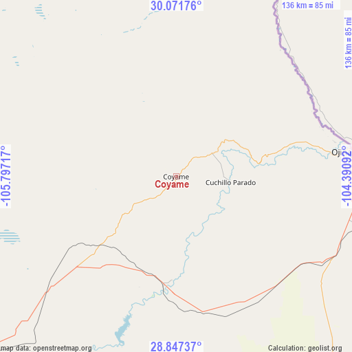
Coyame GPS coordinates[2]
29° 27' 41.076" North, 105° 5' 38.544" West
| Map corner | latitude | longitude |
|---|---|---|
| Upper-left | 30.07176°, | -105.79717° |
| Center: | 29.46141°, | -105.09404° |
| Lower-right: | 28.84737°, | -104.39092° |
| Map W x H: | 136.1×136.1 km | = 84.6×84.6mi |
| max Lat: | 32.7° ⇑1.7% North |
| Coyame: | 29.46141° |
| min Lat: | ⇓98.3% South 14.53588° |
| min Long | Coyame | max Long |
| -117.105° | -105.09404° | -86.73105° |
| W 8%⇐ | ⇒92% E |
Elevation
Elevation of Coyame is 1258 m = 4127 ft, and this is 4.3 m = 14 ft above average elevation for this country.
| Max E: |
3497 m = 11473 ft | 53.7% |
| Coyame | 1258 m 4127 ft | |
| Avg. | 1253.7 m = 4113 ft | |
Min E: |
-1 m = -3 ft | 46.3% |
See also: Mexico elevation on elevation.city.
Geographical zone
Coyame is located in North temperate zone (between Tropic of Cancer and the Arctic Circle). Distance of this Northern Tropic circle is 669.9 km =416.3 mi to South.| Distance of | km | miles | from Coyame |
|---|---|---|---|
| North Pole | 6731.3 | 4182.6 | to North |
| Arctic Circle | 4125.4 | 2563.4 | to North |
| Tropic Cancer | 669.9 | 416.3 | to South |
| Equator | 3275.8 | 2035.5 | to South |


Nearby cities:
15 places around Coyame: (largest is in red/bold)
• Aldama
105.7 km =65.7 mi,  228°
228°
• Barranco Blanco
124.4 km =77.3 mi,  203°
203°
• Colonia Esperanza
118.1 km =73.4 mi, 197°
• Colonia San José
124.5 km =77.4 mi, 195°
• El Sauz
121.3 km =75.4 mi,  247°
247°
• Julimes
119.8 km =74.4 mi, 195°
• La Mesa
114.7 km =71.3 mi, 227°
• La Regina
122.1 km =75.9 mi, 196°
• Manuel Benavides
121.7 km =75.6 mi,  108°
108°
• Manuel Ojinaga
66.6 km =41.4 mi,  80°
80°
• Ninguno [CERESO]
125.4 km =77.9 mi,  220°
220°
• Ojinaga
54.4 km =33.8 mi, 77°
• Salón de Actos (Ampliación Cuarenta y Siete)
115.9 km =72 mi, 202°
• San Carlos
121.7 km =75.6 mi, 108°
• Santa Eulalia
123.5 km =76.7 mi, 218°
Sources, notices
• [Note1] Compared only with cities in Mexico existing in our database
• [Src1] Map data: © OpenStreetMap contributors (CC-BY-SA)
• [Src2] Other city data from geonames.org with taken over terms of usage.
• [Src3] Geographical zone / Annual Mean Temperature by Robert A. Rohde @ Wikipedia
