Manuel Benavides geodata
Manuel Benavides (Chihuahua) is a populated place; located in Mexico in America/Chihuahua (GMT-6) time zone. With population of 916 people, there are 9527 cities with bigger population in this country. Compared to other cities in Mexico, 98.1% of cities are located further ↓South; 89.7% of cities are located further →East and 58.7% of cities have higher elevation than Manuel Benavides. Note1


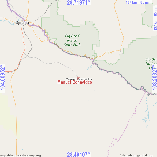
Manuel Benavides GPS coordinates[2]
29° 6' 25.992" North, 103° 54' 23.004" West
| Map corner | latitude | longitude |
|---|---|---|
| Upper-left | 29.71971°, | -104.60952° |
| Center: | 29.10722°, | -103.90639° |
| Lower-right: | 28.49107°, | -103.20327° |
| Map W x H: | 136.6×136.6 km | = 84.9×84.9mi |
| max Lat: | 32.7° ⇑1.9% North |
| Manuel Benavides: | 29.10722° |
| min Lat: | ⇓98.1% South 14.53588° |
| min Long | Manuel Benavide | max Long |
| -117.105° | -103.90639° | -86.73105° |
| W 10.3%⇐ | ⇒89.7% E |
Elevation
Elevation of Manuel Benavides is 1066 m = 3497 ft, and this is 187.7 m = 616 ft below average elevation for this country.
| Max E: |
3497 m = 11473 ft | 58.7% |
| Avg. | 1253.7 m = 4113 ft | |
| Manuel Benavides | 1066 m = 3497 ft | |
Min E: |
-1 m = -3 ft | 41.3% |
See also: Mexico elevation on elevation.city.
Geographical zone
Manuel Benavides is located in North temperate zone (between Tropic of Cancer and the Arctic Circle). Distance of this Northern Tropic circle is 630.5 km =391.8 mi to South.| Distance of | km | miles | from Manuel Benavides |
|---|---|---|---|
| North Pole | 6770.6 | 4207.1 | to North |
| Arctic Circle | 4164.8 | 2587.9 | to North |
| Tropic Cancer | 630.5 | 391.8 | to South |
| Equator | 3236.4 | 2011 | to South |


Nearby cities:
15 places around Manuel Benavides: (largest is in red/bold)
• Colonia Esperanza
167.8 km =104.3 mi,  244°
244°
• Colonia San José
169.8 km =105.5 mi, 241°
• Coyame
121.7 km =75.6 mi,  288°
288°
• El Torreón
170.7 km =106.1 mi, 239°
• Guadalupe Victoria
171.5 km =106.6 mi, 239°
• Hércules
118.9 km =73.9 mi,  174°
174°
• Jiménez
169.2 km =105.1 mi, 239°
• Julimes
166.6 km =103.5 mi, 242°
• La Perla
108.9 km =67.7 mi,  215°
215°
• La Regina
169.2 km =105.1 mi, 242°
• Los García
170.3 km =105.8 mi, 240°
• Manuel Ojinaga
70.9 km =44.1 mi,  315°
315°
• Ojinaga
80.3 km =49.9 mi,  309°
309°
• Orranteño
173.4 km =107.7 mi,  233°
233°
• San Carlos
0.1 km =0.1 mi, 231°
Sources, notices
• [Note1] Compared only with cities in Mexico existing in our database
• [Src1] Map data: © OpenStreetMap contributors (CC-BY-SA)
• [Src2] Other city data from geonames.org with taken over terms of usage.
• [Src3] Geographical zone / Annual Mean Temperature by Robert A. Rohde @ Wikipedia
