Carranco geodata
Carranco (San Luis Potosí) is a populated place; located in Mexico in America/Mexico_City (GMT-6) time zone. With population of 1,918 people, there are 4534 cities with bigger population in this country. Compared to other cities in Mexico, 83.1% of cities are located further ↓South; 74.2% of cities are located further →East and 70.4% of cities have lower elevation than Carranco. Note1


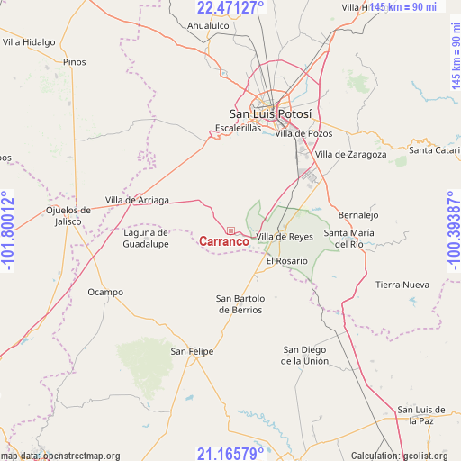
Carranco GPS coordinates[2]
21° 49' 12.072" North, 101° 5' 49.164" West
| Map corner | latitude | longitude |
|---|---|---|
| Upper-left | 22.47127°, | -101.80012° |
| Center: | 21.82002°, | -101.09699° |
| Lower-right: | 21.16579°, | -100.39387° |
| Map W x H: | 145.2×145.2 km | = 90.2×90.2mi |
| max Lat: | 32.7° ⇑16.9% North |
| Carranco: | 21.82002° |
| min Lat: | ⇓83.1% South 14.53588° |
| min Long | Carranco | max Long |
| -117.105° | -101.09699° | -86.73105° |
| W 25.8%⇐ | ⇒74.2% E |
Elevation
Elevation of Carranco is 1932 m = 6339 ft, and this is 678.3 m = 2225 ft above average elevation for this country.
| Max E: |
3497 m = 11473 ft | 29.6% |
| Carranco | 1932 m 6339 ft | |
| Avg. | 1253.7 m = 4113 ft | |
Min E: |
-1 m = -3 ft | 70.4% |
See also: Mexico elevation on elevation.city.
Geographical zone
Carranco is located in North Torrid zone (between Equator and Tropic of Cancer). Distance of this Northern Tropic circle is 179.8 km =111.7 mi to North.| Distance of | km | miles | from Carranco |
|---|---|---|---|
| North Pole | 7580.9 | 4710.6 | to North |
| Arctic Circle | 4975 | 3091.3 | to North |
| Tropic Cancer | 179.8 | 111.7 | to North |
| Equator | 2426.2 | 1507.6 | to South |


Nearby cities:
15 places around Carranco: (largest is in red/bold)
• Alberto Carrera Torres
10.3 km =6.4 mi,  121°
121°
• Bledos
3.1 km =1.9 mi,  319°
319°
• Ejido Gogorrón (Ex-Hacienda de Gogorrón)
19.3 km =12 mi,  83°
83°
• Ejido el Saucillo
10.7 km =6.6 mi, 80°
• El Centenario
16.4 km =10.2 mi,  108°
108°
• El Rosario
20 km =12.4 mi, 118°
• El Zapote
10.6 km =6.6 mi,  152°
152°
• Estancia de San Francisco
17.4 km =10.8 mi,  168°
168°
• Guadalupe
17 km =10.6 mi,  132°
132°
• Guadiana
10.5 km =6.5 mi, 111°
• La Ventilla
8.6 km =5.3 mi, 126°
• Machado
17.6 km =10.9 mi,  70°
70°
• Rodrigo
16.8 km =10.4 mi,  61°
61°
• San Miguel
16.9 km =10.5 mi, 114°
• Villa de Reyes
16.9 km =10.5 mi,  96°
96°
Sources, notices
• [Note1] Compared only with cities in Mexico existing in our database
• [Src1] Map data: © OpenStreetMap contributors (CC-BY-SA)
• [Src2] Other city data from geonames.org with taken over terms of usage.
• [Src3] Geographical zone / Annual Mean Temperature by Robert A. Rohde @ Wikipedia
