Villa de Reyes geodata
Villa de Reyes (San Luis Potosí) is a seat of a second-order administrative division; located in Mexico in America/Mexico_City (GMT-6) time zone. With population of 10,383 people, there are 917 cities with bigger population in this country. Compared to other cities in Mexico, 83% of cities are located further ↓South; 72.9% of cities are located further →East and 64.5% of cities have lower elevation than Villa de Reyes. Note1


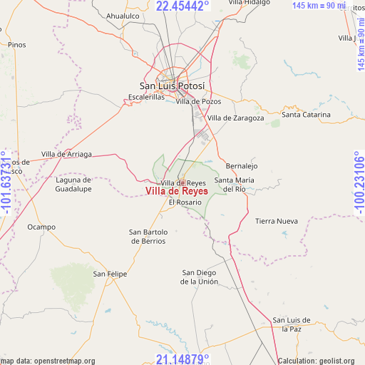
Villa de Reyes GPS coordinates[2]
21° 48' 11.124" North, 100° 56' 3.048" West
| Map corner | latitude | longitude |
|---|---|---|
| Upper-left | 22.45442°, | -101.63731° |
| Center: | 21.80309°, | -100.93418° |
| Lower-right: | 21.14879°, | -100.23106° |
| Map W x H: | 145.2×145.2 km | = 90.2×90.2mi |
| max Lat: | 32.7° ⇑17% North |
| Villa de Reyes: | 21.80309° |
| min Lat: | ⇓83% South 14.53588° |
| min Long | Villa de Reyes | max Long |
| -117.105° | -100.93418° | -86.73105° |
| W 27.1%⇐ | ⇒72.9% E |
Elevation
Elevation of Villa de Reyes is 1815 m = 5955 ft, and this is 561.3 m = 1842 ft above average elevation for this country.
| Max E: |
3497 m = 11473 ft | 35.5% |
| Villa de Reyes | 1815 m 5955 ft | |
| Avg. | 1253.7 m = 4113 ft | |
Min E: |
-1 m = -3 ft | 64.5% |
See also: Mexico elevation on elevation.city.
Geographical zone
Villa de Reyes is located in North Torrid zone (between Equator and Tropic of Cancer). Distance of this Northern Tropic circle is 181.6 km =112.8 mi to North.| Distance of | km | miles | from Villa de Reyes |
|---|---|---|---|
| North Pole | 7582.8 | 4711.7 | to North |
| Arctic Circle | 4976.9 | 3092.5 | to North |
| Tropic Cancer | 181.6 | 112.8 | to North |
| Equator | 2424.3 | 1506.4 | to South |


Nearby cities:
15 places around Villa de Reyes: (largest is in red/bold)
• Alberto Carrera Torres
8.7 km =5.4 mi,  246°
246°
• Ejido Gogorrón (Ex-Hacienda de Gogorrón)
4.7 km =2.9 mi,  29°
29°
• Ejido el Saucillo
7.3 km =4.5 mi,  300°
300°
• El Centenario
3.4 km =2.1 mi,  200°
200°
• El Mirador
13.1 km =8.1 mi,  38°
38°
• El Rosario
7.7 km =4.8 mi,  173°
173°
• Emiliano Zapata
13.3 km =8.3 mi,  9°
9°
• Guadalupe
10.6 km =6.6 mi, 204°
• Guadiana
7.3 km =4.5 mi, 254°
• La Ventilla
10.4 km =6.5 mi, 251°
• Machado
7.9 km =4.9 mi,  358°
358°
• Pardo
12.1 km =7.5 mi, 41°
• Rodrigo
10 km =6.2 mi,  348°
348°
• San Miguel
5.3 km =3.3 mi, 195°
• Socavón (El Carmen)
8.4 km =5.2 mi,  50°
50°
Sources, notices
• [Note1] Compared only with cities in Mexico existing in our database
• [Src1] Map data: © OpenStreetMap contributors (CC-BY-SA)
• [Src2] Other city data from geonames.org with taken over terms of usage.
• [Src3] Geographical zone / Annual Mean Temperature by Robert A. Rohde @ Wikipedia
