Benito Juárez geodata
Benito Juárez (Michoacán) is a populated place; located in Mexico in America/Mexico_City (GMT-6) time zone. With population of 3,074 people, there are 2934 cities with bigger population in this country. Compared to other cities in Mexico, 60.3% of cities are located further ↑North; 69.2% of cities are located further →East and 56.7% of cities have higher elevation than Benito Juárez. Note1


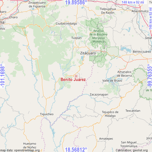
Benito Juárez GPS coordinates[2]
19° 13' 59.988" North, 100° 28' 0.012" West
| Map corner | latitude | longitude |
|---|---|---|
| Upper-left | 19.89586°, | -101.1698° |
| Center: | 19.23333°, | -100.46667° |
| Lower-right: | 18.56812°, | -99.76355° |
| Map W x H: | 147.6×147.6 km | = 91.7×91.7mi |
| max Lat: | 32.7° ⇑60.3% North |
| Benito Juárez: | 19.23333° |
| min Lat: | ⇓39.7% South 14.53588° |
| min Long | Benito Juárez | max Long |
| -117.105° | -100.46667° | -86.73105° |
| W 30.8%⇐ | ⇒69.2% E |
Elevation
Elevation of Benito Juárez is 1129 m = 3704 ft, and this is 124.7 m = 409 ft below average elevation for this country.
| Max E: |
3497 m = 11473 ft | 56.7% |
| Avg. | 1253.7 m = 4113 ft | |
| Benito Juárez | 1129 m = 3704 ft | |
Min E: |
-1 m = -3 ft | 43.3% |
See also: Mexico elevation on elevation.city.
Geographical zone
Benito Juárez is located in North Torrid zone (between Equator and Tropic of Cancer). Distance of this Northern Tropic circle is 467.4 km =290.4 mi to North.| Distance of | km | miles | from Benito Juárez |
|---|---|---|---|
| North Pole | 7868.5 | 4889.3 | to North |
| Arctic Circle | 5262.6 | 3270 | to North |
| Tropic Cancer | 467.4 | 290.4 | to North |
| Equator | 2138.5 | 1328.8 | to South |


Nearby cities:
15 places around Benito Juárez: (largest is in red/bold)
• Arroyo Seco
12.8 km =8 mi,  254°
254°
• Benito Juárez
9.6 km =6 mi,  21°
21°
• Cerro Colorado de Ocampo
9.3 km =5.8 mi,  0°
0°
• Dolores (Ex-Hacienda de Dolores)
12.7 km =7.9 mi,  85°
85°
• El Rodeo
8.1 km =5 mi,  357°
357°
• Enandio
11.8 km =7.3 mi, 19°
• Ignacio López Rayón (Coyota Primera Manzana)
16.9 km =10.5 mi,  11°
11°
• La Florida
14.3 km =8.9 mi,  344°
344°
• Manzana de la Mora
11.9 km =7.4 mi, 336°
• Parícuaro
3.2 km =2 mi, 15°
• Rancho Viejo
5.5 km =3.4 mi,  71°
71°
• Santa Ana de Guerrero (El Cascabel)
5.5 km =3.4 mi,  28°
28°
• Susupuato de Guerrero
6.5 km =4 mi,  108°
108°
• Tremesino
5.8 km =3.6 mi,  150°
150°
• Tuzantla
11 km =6.8 mi, 252°
Sources, notices
• [Note1] Compared only with cities in Mexico existing in our database
• [Src1] Map data: © OpenStreetMap contributors (CC-BY-SA)
• [Src2] Other city data from geonames.org with taken over terms of usage.
• [Src3] Geographical zone / Annual Mean Temperature by Robert A. Rohde @ Wikipedia
