Arroyo Seco geodata
Arroyo Seco (Michoacán) is a populated place; located in Mexico in America/Mexico_City (GMT-6) time zone. With population of 755 people, there are 11595 cities with bigger population in this country. Compared to other cities in Mexico, 61.1% of cities are located further ↑North; 70.2% of cities are located further →East and 66.8% of cities have higher elevation than Arroyo Seco. Note1


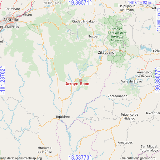
Arroyo Seco GPS coordinates[2]
19° 12' 11.016" North, 100° 35' 2.004" West
| Map corner | latitude | longitude |
|---|---|---|
| Upper-left | 19.86571°, | -101.28702° |
| Center: | 19.20306°, | -100.58389° |
| Lower-right: | 18.53773°, | -99.88077° |
| Map W x H: | 147.7×147.7 km | = 91.8×91.8mi |
| max Lat: | 32.7° ⇑61.1% North |
| Arroyo Seco: | 19.20306° |
| min Lat: | ⇓38.9% South 14.53588° |
| min Long | Arroyo Seco | max Long |
| -117.105° | -100.58389° | -86.73105° |
| W 29.8%⇐ | ⇒70.2% E |
Elevation
Elevation of Arroyo Seco is 595 m = 1952 ft, and this is 658.7 m = 2161 ft below average elevation for this country.
| Max E: |
3497 m = 11473 ft | 66.8% |
| Avg. | 1253.7 m = 4113 ft | |
| Arroyo Seco | 595 m = 1952 ft | |
Min E: |
-1 m = -3 ft | 33.2% |
See also: Mexico elevation on elevation.city.
Geographical zone
Arroyo Seco is located in North Torrid zone (between Equator and Tropic of Cancer). Distance of this Northern Tropic circle is 470.7 km =292.5 mi to North.| Distance of | km | miles | from Arroyo Seco |
|---|---|---|---|
| North Pole | 7871.9 | 4891.4 | to North |
| Arctic Circle | 5266 | 3272.1 | to North |
| Tropic Cancer | 470.7 | 292.5 | to North |
| Equator | 2135.2 | 1326.8 | to South |


Nearby cities:
15 places around Arroyo Seco: (largest is in red/bold)
• Benito Juárez
12.8 km =8 mi,  74°
74°
• Benito Juárez
20 km =12.4 mi,  52°
52°
• Cerro Colorado de Ocampo
17.8 km =11.1 mi,  44°
44°
• El Olivo
14.2 km =8.8 mi,  348°
348°
• El Rodeo
16.5 km =10.3 mi, 46°
• Enandio
21.7 km =13.5 mi, 48°
• La Florida
19.1 km =11.9 mi,  26°
26°
• Las Juntas del Tanque
8.6 km =5.3 mi,  247°
247°
• Manzana de la Mora
16.2 km =10.1 mi, 27°
• Parícuaro
14.7 km =9.1 mi,  63°
63°
• Rancho Viejo
18.2 km =11.3 mi, 73°
• Santa Ana de Guerrero (El Cascabel)
17 km =10.6 mi, 61°
• Susupuato de Guerrero
18.5 km =11.5 mi,  85°
85°
• Tremesino
15.2 km =9.4 mi,  96°
96°
• Tuzantla
1.8 km =1.1 mi, 90°
Sources, notices
• [Note1] Compared only with cities in Mexico existing in our database
• [Src1] Map data: © OpenStreetMap contributors (CC-BY-SA)
• [Src2] Other city data from geonames.org with taken over terms of usage.
• [Src3] Geographical zone / Annual Mean Temperature by Robert A. Rohde @ Wikipedia
