Belén geodata
Belén (Guanajuato) is a populated place; located in Mexico in America/Mexico_City (GMT-6) time zone. With population of 698 people, there are 12480 cities with bigger population in this country. Compared to other cities in Mexico, 64.9% of cities are located further ↓South; 69.7% of cities are located further →East and 75.6% of cities have lower elevation than Belén. Note1


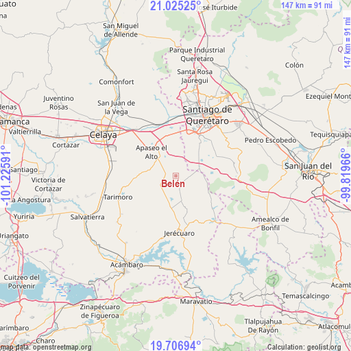
Belén GPS coordinates[2]
20° 22' 3" North, 100° 31' 22.008" West
| Map corner | latitude | longitude |
|---|---|---|
| Upper-left | 21.02525°, | -101.22591° |
| Center: | 20.3675°, | -100.52278° |
| Lower-right: | 19.70694°, | -99.81966° |
| Map W x H: | 146.6×146.6 km | = 91.1×91.1mi |
| max Lat: | 32.7° ⇑35.1% North |
| Belén: | 20.3675° |
| min Lat: | ⇓64.9% South 14.53588° |
| min Long | Belén | max Long |
| -117.105° | -100.52278° | -86.73105° |
| W 30.3%⇐ | ⇒69.7% E |
Elevation
Elevation of Belén is 2041 m = 6696 ft, and this is 787.3 m = 2583 ft above average elevation for this country.
| Max E: |
3497 m = 11473 ft | 24.4% |
| Belén | 2041 m 6696 ft | |
| Avg. | 1253.7 m = 4113 ft | |
Min E: |
-1 m = -3 ft | 75.6% |
See also: Mexico elevation on elevation.city.
Geographical zone
Belén is located in North Torrid zone (between Equator and Tropic of Cancer). Distance of this Northern Tropic circle is 341.3 km =212.1 mi to North.| Distance of | km | miles | from Belén |
|---|---|---|---|
| North Pole | 7742.4 | 4810.9 | to North |
| Arctic Circle | 5136.5 | 3191.7 | to North |
| Tropic Cancer | 341.3 | 212.1 | to North |
| Equator | 2264.7 | 1407.2 | to South |


Nearby cities:
15 places around Belén: (largest is in red/bold)
• Aguaje de Espejo
7.4 km =4.6 mi,  341°
341°
• Barajas
10.5 km =6.5 mi,  298°
298°
• Candelas
9.8 km =6.1 mi,  128°
128°
• Charco Blanco
9.1 km =5.7 mi,  35°
35°
• El Espejo
8.8 km =5.5 mi, 338°
• El Jaral
8.3 km =5.2 mi,  58°
58°
• El Salto de Espejo
9.4 km =5.8 mi,  10°
10°
• El Tepozán
4.4 km =2.7 mi,  144°
144°
• Jiménez
5.5 km =3.4 mi,  209°
209°
• La Cuevita
6.7 km =4.2 mi,  241°
241°
• La Luisiada
10.1 km =6.3 mi,  310°
310°
• Mandujano Atepehuacán
9.4 km =5.8 mi,  320°
320°
• San Isidro de Gamboa
3.1 km =1.9 mi,  351°
351°
• San Lucas
8.8 km =5.5 mi,  200°
200°
• Santa Cruz de Gamboa
2.5 km =1.6 mi,  15°
15°
Sources, notices
• [Note1] Compared only with cities in Mexico existing in our database
• [Src1] Map data: © OpenStreetMap contributors (CC-BY-SA)
• [Src2] Other city data from geonames.org with taken over terms of usage.
• [Src3] Geographical zone / Annual Mean Temperature by Robert A. Rohde @ Wikipedia
