Bachantahui geodata
Bachantahui (Sonora) is a populated place; located in Mexico in America/Hermosillo (GMT-7) time zone. With population of 700 people, there are 12436 cities with bigger population in this country. Compared to other cities in Mexico, 96% of cities are located further ↓South; 97.7% of cities are located further →East and 98.7% of cities have higher elevation than Bachantahui. Note1


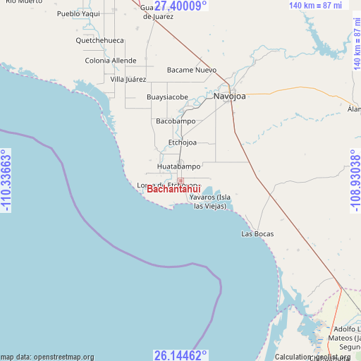
Bachantahui GPS coordinates[2]
26° 46' 26.724" North, 109° 38' 0.6" West
| Map corner | latitude | longitude |
|---|---|---|
| Upper-left | 27.40009°, | -110.33663° |
| Center: | 26.77409°, | -109.6335° |
| Lower-right: | 26.14462°, | -108.93038° |
| Map W x H: | 139.6×139.6 km | = 86.7×86.7mi |
| max Lat: | 32.7° ⇑4% North |
| Bachantahui: | 26.77409° |
| min Lat: | ⇓96% South 14.53588° |
| min Long | Bachantahui | max Long |
| -117.105° | -109.6335° | -86.73105° |
| W 2.3%⇐ | ⇒97.7% E |
Elevation
Elevation of Bachantahui is 7 m = 23 ft, and this is 1246.7 m = 4090 ft below average elevation for this country.
| Max E: |
3497 m = 11473 ft | 98.7% |
| Avg. | 1253.7 m = 4113 ft | |
| Bachantahui | 7 m = 23 ft | |
Min E: |
-1 m = -3 ft | 1.3% |
See also: Mexico elevation on elevation.city.
Geographical zone
Bachantahui is located in North temperate zone (between Tropic of Cancer and the Arctic Circle). Distance of this Northern Tropic circle is 371.1 km =230.6 mi to South.| Distance of | km | miles | from Bachantahui |
|---|---|---|---|
| North Pole | 7030.1 | 4368.3 | to North |
| Arctic Circle | 4424.2 | 2749.1 | to North |
| Tropic Cancer | 371.1 | 230.6 | to South |
| Equator | 2977 | 1849.8 | to South |


Nearby cities:
15 places around Bachantahui: (largest is in red/bold)
• 17 de Octubre
7.3 km =4.5 mi,  291°
291°
• El Riíto
0.7 km =0.4 mi,  23°
23°
• El Riíto de Mazaray
3 km =1.9 mi,  203°
203°
• Etchoropo
4.9 km =3 mi,  261°
261°
• Huatabampo
5.8 km =3.6 mi,  351°
351°
• Juraré
7.5 km =4.7 mi, 294°
• La Bocana
13 km =8.1 mi,  344°
344°
• La Escalera
1.7 km =1.1 mi,  281°
281°
• La Sábila
1.3 km =0.8 mi,  138°
138°
• La Unión
5.6 km =3.5 mi,  26°
26°
• Las Parras
10.9 km =6.8 mi,  311°
311°
• Loma de Moroncarit
4.8 km =3 mi,  238°
238°
• Moroncarit
4.9 km =3 mi,  159°
159°
• Navobaxia
7.7 km =4.8 mi,  330°
330°
• San Antonio
3.7 km =2.3 mi,  115°
115°
Sources, notices
• [Note1] Compared only with cities in Mexico existing in our database
• [Src1] Map data: © OpenStreetMap contributors (CC-BY-SA)
• [Src2] Other city data from geonames.org with taken over terms of usage.
• [Src3] Geographical zone / Annual Mean Temperature by Robert A. Rohde @ Wikipedia
