Apaseo el Grande geodata
Apaseo el Grande (Guanajuato) is a seat of a second-order administrative division; located in Mexico in America/Mexico_City (GMT-6) time zone. With population of 26,121 people, there are 385 cities with bigger population in this country. Compared to other cities in Mexico, 68.8% of cities are located further ↓South; 71% of cities are located further →East and 62.8% of cities have lower elevation than Apaseo el Grande. Note1


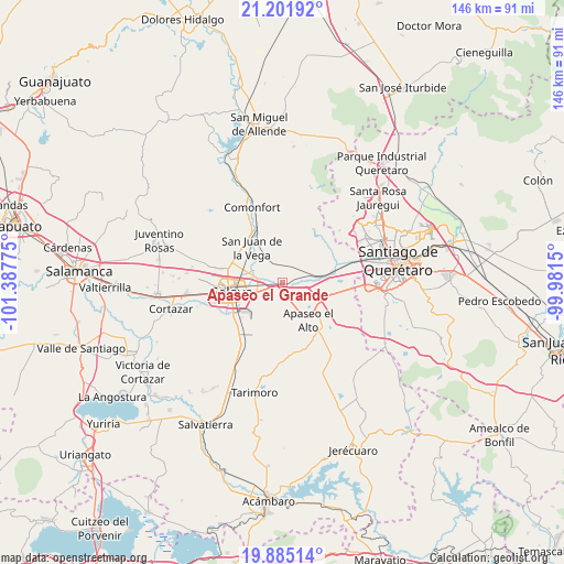
Apaseo el Grande GPS coordinates[2]
20° 32' 41.82" North, 100° 41' 4.632" West
| Map corner | latitude | longitude |
|---|---|---|
| Upper-left | 21.20192°, | -101.38775° |
| Center: | 20.54495°, | -100.68462° |
| Lower-right: | 19.88514°, | -99.9815° |
| Map W x H: | 146.4×146.4 km | = 91×91mi |
| max Lat: | 32.7° ⇑31.2% North |
| Apaseo el Grande: | 20.54495° |
| min Lat: | ⇓68.8% South 14.53588° |
| min Long | Apaseo el Grand | max Long |
| -117.105° | -100.68462° | -86.73105° |
| W 29%⇐ | ⇒71% E |
Elevation
Elevation of Apaseo el Grande is 1774 m = 5820 ft, and this is 520.3 m = 1707 ft above average elevation for this country.
| Max E: |
3497 m = 11473 ft | 37.2% |
| Apaseo el Grande | 1774 m 5820 ft | |
| Avg. | 1253.7 m = 4113 ft | |
Min E: |
-1 m = -3 ft | 62.8% |
See also: Mexico elevation on elevation.city.
Geographical zone
Apaseo el Grande is located in North Torrid zone (between Equator and Tropic of Cancer). Distance of this Northern Tropic circle is 321.5 km =199.8 mi to North.| Distance of | km | miles | from Apaseo el Grande |
|---|---|---|---|
| North Pole | 7722.7 | 4798.7 | to North |
| Arctic Circle | 5116.8 | 3179.4 | to North |
| Tropic Cancer | 321.5 | 199.8 | to North |
| Equator | 2284.4 | 1419.5 | to South |


Nearby cities:
15 places around Apaseo el Grande: (largest is in red/bold)
• El Tunal
7.3 km =4.5 mi,  67°
67°
• El Vicarlo
4.4 km =2.7 mi,  18°
18°
• Estancia del Llano
5.8 km =3.6 mi,  229°
229°
• Guadalupe del Monte
4.8 km =3 mi, 73°
• Jauregui
6.4 km =4 mi,  325°
325°
• Jocoqui
4.4 km =2.7 mi,  340°
340°
• La Labor
2.2 km =1.4 mi,  235°
235°
• La Palma
3.5 km =2.2 mi,  202°
202°
• La Purísima
3.6 km =2.2 mi,  159°
159°
• Rancho Nuevo
6.3 km =3.9 mi,  254°
254°
• San José Viborillas
5.9 km =3.7 mi,  64°
64°
• San José de Agua Azul
7.1 km =4.4 mi, 155°
• San Pedro Tenango
6.8 km =4.2 mi,  127°
127°
• San Ramón
3.3 km =2.1 mi,  310°
310°
• Tenango el Nuevo
2 km =1.2 mi,  138°
138°
Sources, notices
• [Note1] Compared only with cities in Mexico existing in our database
• [Src1] Map data: © OpenStreetMap contributors (CC-BY-SA)
• [Src2] Other city data from geonames.org with taken over terms of usage.
• [Src3] Geographical zone / Annual Mean Temperature by Robert A. Rohde @ Wikipedia
