Allende geodata
Allende (Coahuila) is a seat of a second-order administrative division; located in Mexico in America/Monterrey (GMT-6) time zone. With population of 20,694 people, there are 491 cities with bigger population in this country. Compared to other cities in Mexico, 97.6% of cities are located further ↓South; 72.2% of cities are located further →East and 70.7% of cities have higher elevation than Allende. Note1


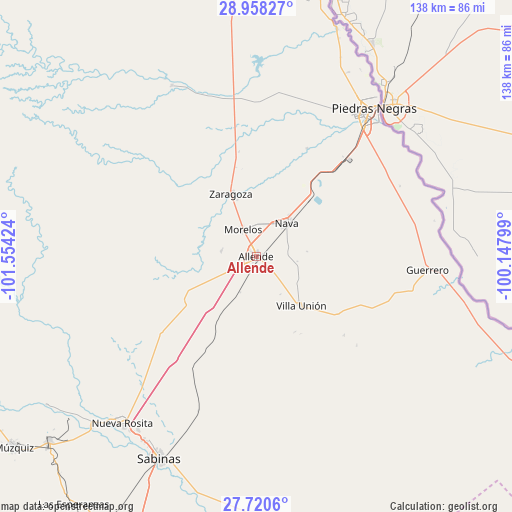
Allende GPS coordinates[2]
28° 20' 28.464" North, 100° 51' 3.996" West
| Map corner | latitude | longitude |
|---|---|---|
| Upper-left | 28.95827°, | -101.55424° |
| Center: | 28.34124°, | -100.85111° |
| Lower-right: | 27.7206°, | -100.14799° |
| Map W x H: | 137.6×137.6 km | = 85.5×85.5mi |
| max Lat: | 32.7° ⇑2.4% North |
| Allende: | 28.34124° |
| min Lat: | ⇓97.6% South 14.53588° |
| min Long | Allende | max Long |
| -117.105° | -100.85111° | -86.73105° |
| W 27.8%⇐ | ⇒72.2% E |
Elevation
Elevation of Allende is 385 m = 1263 ft, and this is 868.7 m = 2850 ft below average elevation for this country.
| Max E: |
3497 m = 11473 ft | 70.7% |
| Avg. | 1253.7 m = 4113 ft | |
| Allende | 385 m = 1263 ft | |
Min E: |
-1 m = -3 ft | 29.3% |
See also: Mexico elevation on elevation.city.
Geographical zone
Allende is located in North temperate zone (between Tropic of Cancer and the Arctic Circle). Distance of this Northern Tropic circle is 545.3 km =338.8 mi to South.| Distance of | km | miles | from Allende |
|---|---|---|---|
| North Pole | 6855.8 | 4260 | to North |
| Arctic Circle | 4249.9 | 2640.8 | to North |
| Tropic Cancer | 545.3 | 338.8 | to South |
| Equator | 3151.3 | 1958.1 | to South |


Nearby cities:
15 places around Allende: (largest is in red/bold)
• Centro de Readaptación Social Piedras Negras
53.8 km =33.4 mi,  26°
26°
• Cloete
56.5 km =35.1 mi,  214°
214°
• Colonia Venustiano Carranza
43.8 km =27.2 mi,  41°
41°
• Fraccionamiento Villa Real
47.1 km =29.3 mi, 33°
• Guerrero
46.2 km =28.7 mi,  94°
94°
• Los Álamos
9.4 km =5.8 mi,  280°
280°
• Morelos
8.2 km =5.1 mi,  333°
333°
• Nava
12.2 km =7.6 mi, 43°
• Nueva Rosita
57.3 km =35.6 mi,  218°
218°
• Paso del Tío Pío
16.1 km =10 mi,  341°
341°
• Piedras Negras
51.1 km =31.8 mi, 38°
• Río Bravo
7.2 km =4.5 mi,  243°
243°
• Villa Union
19.1 km =11.9 mi,  136°
136°
• Villa Unión
18 km =11.2 mi, 137°
• Zaragoza
18.3 km =11.4 mi, 337°
Sources, notices
• [Note1] Compared only with cities in Mexico existing in our database
• [Src1] Map data: © OpenStreetMap contributors (CC-BY-SA)
• [Src2] Other city data from geonames.org with taken over terms of usage.
• [Src3] Geographical zone / Annual Mean Temperature by Robert A. Rohde @ Wikipedia
