Ahuacapán geodata
Ahuacapán (Jalisco) is a populated place; located in Mexico in America/Mexico_City (GMT-6) time zone. With population of 985 people, there are 8829 cities with bigger population in this country. Compared to other cities in Mexico, 50.2% of cities are located further ↑North; 90.6% of cities are located further →East and 60.9% of cities have higher elevation than Ahuacapán. Note1


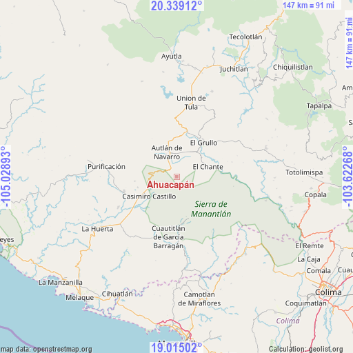
Ahuacapán GPS coordinates[2]
19° 40' 42.384" North, 104° 19' 32.88" West
| Map corner | latitude | longitude |
|---|---|---|
| Upper-left | 20.33912°, | -105.02893° |
| Center: | 19.67844°, | -104.3258° |
| Lower-right: | 19.01502°, | -103.62268° |
| Map W x H: | 147.2×147.2 km | = 91.5×91.5mi |
| max Lat: | 32.7° ⇑50.2% North |
| Ahuacapán: | 19.67844° |
| min Lat: | ⇓49.8% South 14.53588° |
| min Long | Ahuacapán | max Long |
| -117.105° | -104.3258° | -86.73105° |
| W 9.4%⇐ | ⇒90.6% E |
Elevation
Elevation of Ahuacapán is 942 m = 3091 ft, and this is 311.7 m = 1023 ft below average elevation for this country.
| Max E: |
3497 m = 11473 ft | 60.9% |
| Avg. | 1253.7 m = 4113 ft | |
| Ahuacapán | 942 m = 3091 ft | |
Min E: |
-1 m = -3 ft | 39.1% |
See also: Mexico elevation on elevation.city.
Geographical zone
Ahuacapán is located in North Torrid zone (between Equator and Tropic of Cancer). Distance of this Northern Tropic circle is 417.9 km =259.7 mi to North.| Distance of | km | miles | from Ahuacapán |
|---|---|---|---|
| North Pole | 7819 | 4858.5 | to North |
| Arctic Circle | 5213.1 | 3239.3 | to North |
| Tropic Cancer | 417.9 | 259.7 | to North |
| Equator | 2188 | 1359.6 | to South |


Nearby cities:
15 places around Ahuacapán: (largest is in red/bold)
• Autlán de Navarro
10.9 km =6.8 mi,  336°
336°
• Ayuquila
18.8 km =11.7 mi,  17°
17°
• Cuzalapa
20.1 km =12.5 mi,  176°
176°
• El Cacalote
19 km =11.8 mi,  14°
14°
• El Chante
13.9 km =8.6 mi,  71°
71°
• El Corcovado
19 km =11.8 mi, 12°
• El Grullo
18.1 km =11.2 mi,  38°
38°
• El Mentidero
10.8 km =6.7 mi, 18°
• La Resolana
14 km =8.7 mi,  234°
234°
• Las Lagunillas
5.8 km =3.6 mi, 42°
• Las Paredes
13.3 km =8.3 mi, 38°
• Mezquitán
16 km =9.9 mi,  356°
356°
• Piedra Pesada
21.3 km =13.2 mi, 228°
• Tecomates
22 km =13.7 mi, 229°
• Zapotillo
13.1 km =8.1 mi,  247°
247°
Sources, notices
• [Note1] Compared only with cities in Mexico existing in our database
• [Src1] Map data: © OpenStreetMap contributors (CC-BY-SA)
• [Src2] Other city data from geonames.org with taken over terms of usage.
• [Src3] Geographical zone / Annual Mean Temperature by Robert A. Rohde @ Wikipedia
