Las Adjuntas geodata
Las Adjuntas (San Luis Potosí) is a populated place; located in Mexico in America/Mexico_City (GMT-6) time zone. With population of 507 people, there are 16589 cities with bigger population in this country. Compared to other cities in Mexico, 83.9% of cities are located further ↓South; 64.7% of cities are located further →East and 59.9% of cities have higher elevation than Las Adjuntas. Note1


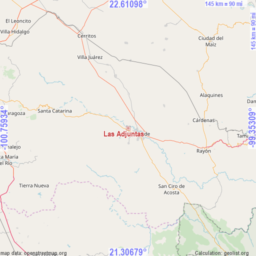
Las Adjuntas GPS coordinates[2]
21° 57' 37.368" North, 100° 3' 22.356" West
| Map corner | latitude | longitude |
|---|---|---|
| Upper-left | 22.61098°, | -100.75934° |
| Center: | 21.96038°, | -100.05621° |
| Lower-right: | 21.30679°, | -99.35309° |
| Map W x H: | 145×145 km | = 90.1×90.1mi |
| max Lat: | 32.7° ⇑16.1% North |
| Las Adjuntas: | 21.96038° |
| min Lat: | ⇓83.9% South 14.53588° |
| min Long | Las Adjuntas | max Long |
| -117.105° | -100.05621° | -86.73105° |
| W 35.3%⇐ | ⇒64.7% E |
Elevation
Elevation of Las Adjuntas is 1008 m = 3307 ft, and this is 245.7 m = 806 ft below average elevation for this country.
| Max E: |
3497 m = 11473 ft | 59.9% |
| Avg. | 1253.7 m = 4113 ft | |
| Las Adjuntas | 1008 m = 3307 ft | |
Min E: |
-1 m = -3 ft | 40.1% |
See also: Mexico elevation on elevation.city.
Geographical zone
Las Adjuntas is located in North Torrid zone (between Equator and Tropic of Cancer). Distance of this Northern Tropic circle is 164.2 km =102 mi to North.| Distance of | km | miles | from Las Adjuntas |
|---|---|---|---|
| North Pole | 7565.3 | 4700.9 | to North |
| Arctic Circle | 4959.4 | 3081.6 | to North |
| Tropic Cancer | 164.2 | 102 | to North |
| Equator | 2441.8 | 1517.3 | to South |


Nearby cities:
15 places around Las Adjuntas: (largest is in red/bold)
• Barrio de Guadalupe
2.1 km =1.3 mi,  28°
28°
• Cieneguilla
7.4 km =4.6 mi,  264°
264°
• Ciudad Fernández
5.1 km =3.2 mi,  115°
115°
• Colonia Veinte de Noviembre
2.2 km =1.4 mi,  17°
17°
• El Jabalí
8.5 km =5.3 mi,  177°
177°
• El Pescadito
10.3 km =6.4 mi,  202°
202°
• La Loma
8.4 km =5.2 mi,  212°
212°
• La Noria
8.8 km =5.5 mi,  313°
313°
• La Reforma
5.8 km =3.6 mi,  317°
317°
• Labor Vieja
10.7 km =6.6 mi,  303°
303°
• Ojo de Agua Seco
12.2 km =7.6 mi,  186°
186°
• Ojo de Agua de Solano
3.7 km =2.3 mi, 319°
• Rioverde
7.1 km =4.4 mi, 117°
• San Diego
6.7 km =4.2 mi,  223°
223°
• San Martín
6.2 km =3.9 mi,  228°
228°
Sources, notices
• [Note1] Compared only with cities in Mexico existing in our database
• [Src1] Map data: © OpenStreetMap contributors (CC-BY-SA)
• [Src2] Other city data from geonames.org with taken over terms of usage.
• [Src3] Geographical zone / Annual Mean Temperature by Robert A. Rohde @ Wikipedia
