Rioverde geodata
Rioverde (San Luis Potosí) is a seat of a second-order administrative division; located in Mexico in America/Mexico_City (GMT-6) time zone. With population of 53,128 people, there are 213 cities with bigger population in this country. Compared to other cities in Mexico, 83.7% of cities are located further ↓South; 63.9% of cities are located further →East and 60.1% of cities have higher elevation than Rioverde. Note1


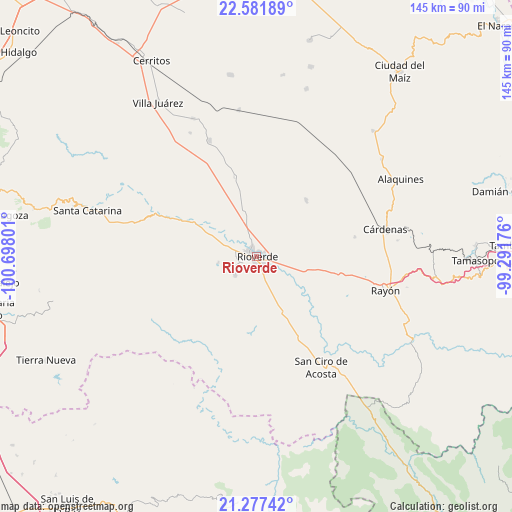
Rioverde GPS coordinates[2]
21° 55' 52.14" North, 99° 59' 41.568" West
| Map corner | latitude | longitude |
|---|---|---|
| Upper-left | 22.58189°, | -100.69801° |
| Center: | 21.93115°, | -99.99488° |
| Lower-right: | 21.27742°, | -99.29176° |
| Map W x H: | 145×145 km | = 90.1×90.1mi |
| max Lat: | 32.7° ⇑16.3% North |
| Rioverde: | 21.93115° |
| min Lat: | ⇓83.7% South 14.53588° |
| min Long | Rioverde | max Long |
| -117.105° | -99.99488° | -86.73105° |
| W 36.1%⇐ | ⇒63.9% E |
Elevation
Elevation of Rioverde is 995 m = 3264 ft, and this is 258.7 m = 849 ft below average elevation for this country.
| Max E: |
3497 m = 11473 ft | 60.1% |
| Avg. | 1253.7 m = 4113 ft | |
| Rioverde | 995 m = 3264 ft | |
Min E: |
-1 m = -3 ft | 39.9% |
See also: Rioverde elevation on elevation.city.
Geographical zone
Rioverde is located in North Torrid zone (between Equator and Tropic of Cancer). Distance of this Northern Tropic circle is 167.4 km =104 mi to North.| Distance of | km | miles | from Rioverde |
|---|---|---|---|
| North Pole | 7568.5 | 4702.8 | to North |
| Arctic Circle | 4962.7 | 3083.7 | to North |
| Tropic Cancer | 167.4 | 104 | to North |
| Equator | 2438.5 | 1515.2 | to South |


Nearby cities:
15 places around Rioverde: (largest is in red/bold)
• Barrio de Guadalupe
7.4 km =4.6 mi,  313°
313°
• Ciudad Fernández
2 km =1.2 mi,  301°
301°
• Colonia Veinte de Noviembre
7.8 km =4.8 mi, 313°
• El Capulín
12.3 km =7.6 mi,  200°
200°
• El Jabalí
8 km =5 mi,  229°
229°
• El Pescadito
12 km =7.5 mi,  238°
238°
• La Loma
11.5 km =7.1 mi,  250°
250°
• La Reforma
12.7 km =7.9 mi, 306°
• Las Adjuntas
7.1 km =4.4 mi, 297°
• Las Magdalenas
10.6 km =6.6 mi,  158°
158°
• Miguel Hidalgo
10.6 km =6.6 mi,  115°
115°
• Ojo de Agua Seco
11.8 km =7.3 mi,  221°
221°
• Ojo de Agua de Solano
10.6 km =6.6 mi, 304°
• San Diego
11.1 km =6.9 mi,  261°
261°
• San Martín
11 km =6.8 mi,  265°
265°
Sources, notices
• [Note1] Compared only with cities in Mexico existing in our database
• [Src1] Map data: © OpenStreetMap contributors (CC-BY-SA)
• [Src2] Other city data from geonames.org with taken over terms of usage.
• [Src3] Geographical zone / Annual Mean Temperature by Robert A. Rohde @ Wikipedia
