La Noria geodata
La Noria (San Luis Potosí) is a populated place; located in Mexico in America/Mexico_City (GMT-6) time zone. With population of 593 people, there are 14492 cities with bigger population in this country. Compared to other cities in Mexico, 84.3% of cities are located further ↓South; 65.4% of cities are located further →East and 59.5% of cities have higher elevation than La Noria. Note1


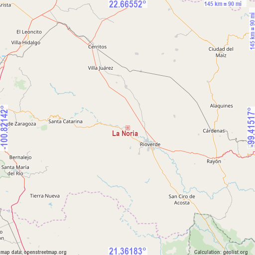
La Noria GPS coordinates[2]
22° 0' 54.612" North, 100° 7' 5.844" West
| Map corner | latitude | longitude |
|---|---|---|
| Upper-left | 22.66552°, | -100.82142° |
| Center: | 22.01517°, | -100.11829° |
| Lower-right: | 21.36183°, | -99.41517° |
| Map W x H: | 145×145 km | = 90.1×90.1mi |
| max Lat: | 32.7° ⇑15.7% North |
| La Noria: | 22.01517° |
| min Lat: | ⇓84.3% South 14.53588° |
| min Long | La Noria | max Long |
| -117.105° | -100.11829° | -86.73105° |
| W 34.6%⇐ | ⇒65.4% E |
Elevation
Elevation of La Noria is 1025 m = 3363 ft, and this is 228.7 m = 750 ft below average elevation for this country.
| Max E: |
3497 m = 11473 ft | 59.5% |
| Avg. | 1253.7 m = 4113 ft | |
| La Noria | 1025 m = 3363 ft | |
Min E: |
-1 m = -3 ft | 40.5% |
See also: Mexico elevation on elevation.city.
Geographical zone
La Noria is located in North Torrid zone (between Equator and Tropic of Cancer). Distance of this Northern Tropic circle is 158.1 km =98.2 mi to North.| Distance of | km | miles | from La Noria |
|---|---|---|---|
| North Pole | 7559.2 | 4697.1 | to North |
| Arctic Circle | 4953.3 | 3077.8 | to North |
| Tropic Cancer | 158.1 | 98.2 | to North |
| Equator | 2447.9 | 1521.1 | to South |


Nearby cities:
15 places around La Noria: (largest is in red/bold)
• Barrio de Guadalupe
8.5 km =5.3 mi,  119°
119°
• Cieneguilla
6.8 km =4.2 mi,  188°
188°
• Ciudad Fernández
13.8 km =8.6 mi,  127°
127°
• Colonia Veinte de Noviembre
8.1 km =5 mi, 119°
• El Pescadito
15.8 km =9.8 mi,  170°
170°
• La Loma
13.4 km =8.3 mi, 171°
• La Reforma
3.1 km =1.9 mi, 126°
• La Tapona
6.5 km =4 mi,  249°
249°
• Labor Vieja
2.5 km =1.6 mi,  264°
264°
• Las Adjuntas
8.8 km =5.5 mi, 133°
• Ojo de Agua de Solano
5.2 km =3.2 mi, 129°
• Pastora
14.8 km =9.2 mi,  25°
25°
• Rioverde
15.8 km =9.8 mi, 126°
• San Diego
11.1 km =6.9 mi, 170°
• San Martín
10.3 km =6.4 mi, 170°
Sources, notices
• [Note1] Compared only with cities in Mexico existing in our database
• [Src1] Map data: © OpenStreetMap contributors (CC-BY-SA)
• [Src2] Other city data from geonames.org with taken over terms of usage.
• [Src3] Geographical zone / Annual Mean Temperature by Robert A. Rohde @ Wikipedia
