La Escondida geodata
La Escondida (Aguascalientes) is a populated place; located in Mexico in America/Mexico_City (GMT-6) time zone. With population of 1,318 people, there are 6582 cities with bigger population in this country. Compared to other cities in Mexico, 84.4% of cities are located further ↓South; 82.5% of cities are located further →East and 69.2% of cities have lower elevation than La Escondida. Note1


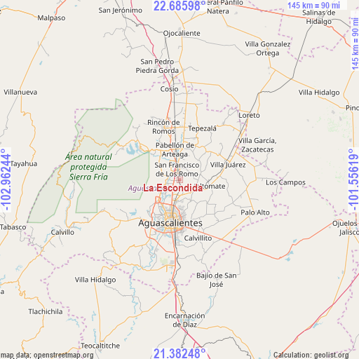
La Escondida GPS coordinates[2]
22° 2' 8.628" North, 102° 15' 33.516" West
| Map corner | latitude | longitude |
|---|---|---|
| Upper-left | 22.68598°, | -102.96244° |
| Center: | 22.03573°, | -102.25931° |
| Lower-right: | 21.38248°, | -101.55619° |
| Map W x H: | 144.9×144.9 km | = 90×90mi |
| max Lat: | 32.7° ⇑15.6% North |
| La Escondida: | 22.03573° |
| min Lat: | ⇓84.4% South 14.53588° |
| min Long | La Escondida | max Long |
| -117.105° | -102.25931° | -86.73105° |
| W 17.5%⇐ | ⇒82.5% E |
Elevation
Elevation of La Escondida is 1911 m = 6270 ft, and this is 657.3 m = 2156 ft above average elevation for this country.
| Max E: |
3497 m = 11473 ft | 30.8% |
| La Escondida | 1911 m 6270 ft | |
| Avg. | 1253.7 m = 4113 ft | |
Min E: |
-1 m = -3 ft | 69.2% |
See also: Mexico elevation on elevation.city.
Geographical zone
La Escondida is located in North Torrid zone (between Equator and Tropic of Cancer). Distance of this Northern Tropic circle is 155.8 km =96.8 mi to North.| Distance of | km | miles | from La Escondida |
|---|---|---|---|
| North Pole | 7556.9 | 4695.6 | to North |
| Arctic Circle | 4951 | 3076.4 | to North |
| Tropic Cancer | 155.8 | 96.8 | to North |
| Equator | 2450.1 | 1522.4 | to South |


Nearby cities:
15 places around La Escondida: (largest is in red/bold)
• Chicalote
2.8 km =1.7 mi,  165°
165°
• Ejido la Guayana (Rancho Seco)
6.3 km =3.9 mi,  192°
192°
• Jesús Gómez Portugal
5.5 km =3.4 mi,  216°
216°
• Jesús Gómez Portugal (Margaritas)
5.2 km =3.2 mi, 219°
• La Concepción
4.2 km =2.6 mi,  269°
269°
• Las Jaulas
5.3 km =3.3 mi,  246°
246°
• Las Ánimas
6.1 km =3.8 mi,  352°
352°
• Loretito (Charco del Toro)
4.1 km =2.5 mi,  156°
156°
• Macario J. Gómez [Colonia]
6.2 km =3.9 mi, 172°
• Paseos de la Providencia [Fraccionamiento]
2.2 km =1.4 mi,  235°
235°
• San Francisco de los Romo
4.8 km =3 mi,  344°
344°
• Santa Isabel [Fraccionamiento]
5.1 km =3.2 mi, 350°
• Valladolid
6 km =3.7 mi, 254°
• Valle de Aguascalientes
6.9 km =4.3 mi,  184°
184°
• Viñedos Rivier
7 km =4.3 mi,  203°
203°
Sources, notices
• [Note1] Compared only with cities in Mexico existing in our database
• [Src1] Map data: © OpenStreetMap contributors (CC-BY-SA)
• [Src2] Other city data from geonames.org with taken over terms of usage.
• [Src3] Geographical zone / Annual Mean Temperature by Robert A. Rohde @ Wikipedia
