Las Jaulas geodata
Las Jaulas (Aguascalientes) is a populated place; located in Mexico in America/Mexico_City (GMT-6) time zone. With population of 635 people, there are 13639 cities with bigger population in this country. Compared to other cities in Mexico, 84.3% of cities are located further ↓South; 82.9% of cities are located further →East and 67.8% of cities have lower elevation than Las Jaulas. Note1


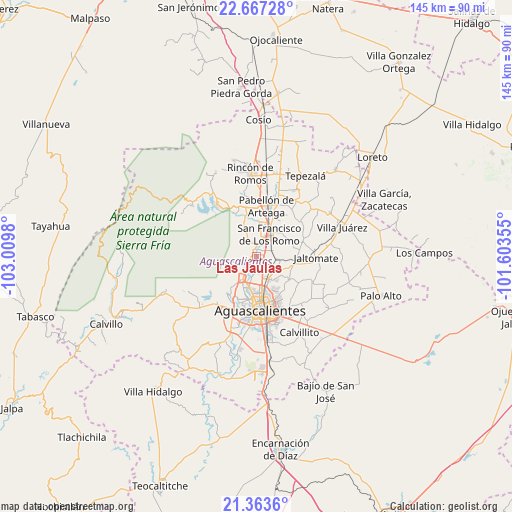
Las Jaulas GPS coordinates[2]
22° 1' 0.984" North, 102° 18' 24.012" West
| Map corner | latitude | longitude |
|---|---|---|
| Upper-left | 22.66728°, | -103.0098° |
| Center: | 22.01694°, | -102.30667° |
| Lower-right: | 21.3636°, | -101.60355° |
| Map W x H: | 145×145 km | = 90.1×90.1mi |
| max Lat: | 32.7° ⇑15.7% North |
| Las Jaulas: | 22.01694° |
| min Lat: | ⇓84.3% South 14.53588° |
| min Long | Las Jaulas | max Long |
| -117.105° | -102.30667° | -86.73105° |
| W 17.1%⇐ | ⇒82.9% E |
Elevation
Elevation of Las Jaulas is 1886 m = 6188 ft, and this is 632.3 m = 2074 ft above average elevation for this country.
| Max E: |
3497 m = 11473 ft | 32.2% |
| Las Jaulas | 1886 m 6188 ft | |
| Avg. | 1253.7 m = 4113 ft | |
Min E: |
-1 m = -3 ft | 67.8% |
See also: Mexico elevation on elevation.city.
Geographical zone
Las Jaulas is located in North Torrid zone (between Equator and Tropic of Cancer). Distance of this Northern Tropic circle is 157.9 km =98.1 mi to North.| Distance of | km | miles | from Las Jaulas |
|---|---|---|---|
| North Pole | 7559 | 4696.9 | to North |
| Arctic Circle | 4953.1 | 3077.7 | to North |
| Tropic Cancer | 157.9 | 98.1 | to North |
| Equator | 2448.1 | 1521.2 | to South |


Nearby cities:
15 places around Las Jaulas: (largest is in red/bold)
• Ejido la Guayana (Rancho Seco)
5.3 km =3.3 mi,  139°
139°
• Jesús Gómez Portugal
2.8 km =1.7 mi,  145°
145°
• Jesús Gómez Portugal (Margaritas)
2.5 km =1.6 mi, 141°
• La Concepción
2.2 km =1.4 mi,  18°
18°
• La Escondida
5.3 km =3.3 mi,  66°
66°
• La Florida
3.8 km =2.4 mi,  176°
176°
• Los Ramírez
5.5 km =3.4 mi,  199°
199°
• Los Vázquez
5.3 km =3.3 mi,  206°
206°
• Miravalle
5 km =3.1 mi,  185°
185°
• Paseos de la Providencia [Fraccionamiento]
3.2 km =2 mi,  75°
75°
• Paseos de las Haciendas [Fraccionamiento]
4.7 km =2.9 mi,  234°
234°
• Paso Blanco
4.9 km =3 mi, 192°
• San Antonio de los Horcones
2.9 km =1.8 mi,  224°
224°
• Valladolid
1 km =0.6 mi,  298°
298°
• Viñedos Rivier
4.8 km =3 mi, 153°
Sources, notices
• [Note1] Compared only with cities in Mexico existing in our database
• [Src1] Map data: © OpenStreetMap contributors (CC-BY-SA)
• [Src2] Other city data from geonames.org with taken over terms of usage.
• [Src3] Geographical zone / Annual Mean Temperature by Robert A. Rohde @ Wikipedia
