Puertecito de la Virgen geodata
Puertecito de la Virgen (Aguascalientes) is a populated place; located in Mexico in America/Mexico_City (GMT-6) time zone. With population of 1,976 people, there are 4412 cities with bigger population in this country. Compared to other cities in Mexico, 83.9% of cities are located further ↓South; 82.5% of cities are located further →East and 70.6% of cities have lower elevation than Puertecito de la Virgen. Note1
Current local time in Puertecito de la Virgen:
10:52 PM, MondayDifference from your time zone: hours


Puertecito de la Virgen GPS coordinates[2]
21° 57' 37.008" North, 102° 16' 8.004" West
| Map corner | latitude | longitude |
|---|---|---|
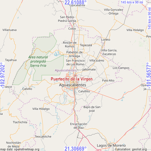
| Upper-left | 22.61088°, | -102.97202° |
| Center: | 21.96028°, | -102.26889° |
| Lower-right: | 21.30669°, | -101.56577° |
| Map W x H: | 145×145 km | = 90.1×90.1mi |
| max Lat: | 32.7° ⇑16.1% North |
| Puertecito de la Virgen: | 21.96028° |
| min Lat: | ⇓83.9% South 14.53588° |
| min Long | Puertecito de l | max Long |
| -117.105° | -102.26889° | -86.73105° |
| W 17.5%⇐ | ⇒82.5% E |
Elevation
Elevation of Puertecito de la Virgen is 1937 m = 6355 ft, and this is 683.3 m = 2242 ft above average elevation for this country.
| Max E: |
3497 m = 11473 ft | 29.4% |
| Puertecito de la Virgen | 1937 m 6355 ft | |
| Avg. | 1253.7 m = 4113 ft | |
Min E: |
-1 m = -3 ft | 70.6% |
See also: Mexico elevation on elevation.city.
Geographical zone
Puertecito de la Virgen is located in North Torrid zone (between Equator and Tropic of Cancer). Distance of this Northern Tropic circle is 164.2 km =102 mi to North.| Distance of | km | miles | from Puertecito de la Virgen |
|---|---|---|---|
| North Pole | 7565.3 | 4700.9 | to North |
| Arctic Circle | 4959.4 | 3081.6 | to North |
| Tropic Cancer | 164.2 | 102 | to North |
| Equator | 2441.8 | 1517.3 | to South |


Nearby cities:
15 places around Puertecito de la Virgen: (largest is in red/bold)
• Arboledas Paso Blanco [Fraccionamiento]
3.4 km =2.1 mi,  276°
276°
• Cartagena [Fraccionamiento]
0.9 km =0.6 mi,  240°
240°
• Cumbres III
5.3 km =3.3 mi,  142°
142°
• Ejido la Guayana (Rancho Seco)
2.3 km =1.4 mi,  349°
349°
• Ex-Viñedos Guadalupe
0.6 km =0.4 mi,  260°
260°
• Jesús Gómez Portugal
4.6 km =2.9 mi,  330°
330°
• Jesús Gómez Portugal (Margaritas)
4.9 km =3 mi, 331°
• La Florida
4.5 km =2.8 mi,  304°
304°
• Loretito (Charco del Toro)
5.4 km =3.4 mi,  29°
29°
• Macario J. Gómez [Colonia]
2.9 km =1.8 mi,  38°
38°
• Miravalle
4.6 km =2.9 mi,  287°
287°
• Montebello Della Stanza [Fraccionamiento]
2.7 km =1.7 mi,  187°
187°
• Paso Blanco
5.2 km =3.2 mi, 286°
• Valle de Aguascalientes
1.6 km =1 mi,  16°
16°
• Viñedos Rivier
2.6 km =1.6 mi,  318°
318°
Sources, notices
• [Note1] Compared only with cities in Mexico existing in our database
• [Src1] Map data: © OpenStreetMap contributors (CC-BY-SA)
• [Src2] Other city data from geonames.org with taken over terms of usage.
• [Src3] Geographical zone / Annual Mean Temperature by Robert A. Rohde @ Wikipedia
