Miravalle geodata
Miravalle (Aguascalientes) is a populated place; located in Mexico in America/Mexico_City (GMT-6) time zone. With population of 1,071 people, there are 8151 cities with bigger population in this country. Compared to other cities in Mexico, 84% of cities are located further ↓South; 82.9% of cities are located further →East and 67% of cities have lower elevation than Miravalle. Note1


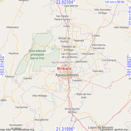
Miravalle GPS coordinates[2]
21° 58' 21" North, 102° 18' 41.004" West
| Map corner | latitude | longitude |
|---|---|---|
| Upper-left | 22.62304°, | -103.01452° |
| Center: | 21.9725°, | -102.31139° |
| Lower-right: | 21.31896°, | -101.60827° |
| Map W x H: | 145×145 km | = 90.1×90.1mi |
| max Lat: | 32.7° ⇑16% North |
| Miravalle: | 21.9725° |
| min Lat: | ⇓84% South 14.53588° |
| min Long | Miravalle | max Long |
| -117.105° | -102.31139° | -86.73105° |
| W 17.1%⇐ | ⇒82.9% E |
Elevation
Elevation of Miravalle is 1870 m = 6135 ft, and this is 616.3 m = 2022 ft above average elevation for this country.
| Max E: |
3497 m = 11473 ft | 33% |
| Miravalle | 1870 m 6135 ft | |
| Avg. | 1253.7 m = 4113 ft | |
Min E: |
-1 m = -3 ft | 67% |
See also: Mexico elevation on elevation.city.
Geographical zone
Miravalle is located in North Torrid zone (between Equator and Tropic of Cancer). Distance of this Northern Tropic circle is 162.8 km =101.2 mi to North.| Distance of | km | miles | from Miravalle |
|---|---|---|---|
| North Pole | 7563.9 | 4700 | to North |
| Arctic Circle | 4958.1 | 3080.8 | to North |
| Tropic Cancer | 162.8 | 101.2 | to North |
| Equator | 2443.1 | 1518.1 | to South |


Nearby cities:
15 places around Miravalle: (largest is in red/bold)
• Arboledas Paso Blanco [Fraccionamiento]
1.4 km =0.9 mi,  135°
135°
• Corral de Barrancos
3.3 km =2.1 mi,  221°
221°
• El Llano
3.4 km =2.1 mi,  200°
200°
• Jesús Gómez Portugal
3.4 km =2.1 mi,  38°
38°
• Jesús Gómez Portugal (Margaritas)
3.6 km =2.2 mi,  34°
34°
• Jesús María
3.5 km =2.2 mi,  248°
248°
• La Florida
1.4 km =0.9 mi, 31°
• Los Arenales
1.5 km =0.9 mi,  226°
226°
• Los Ramírez
1.4 km =0.9 mi,  262°
262°
• Los Vázquez
1.9 km =1.2 mi,  277°
277°
• Maravillas
2.8 km =1.7 mi, 222°
• Paso Blanco
0.6 km =0.4 mi, 282°
• San Antonio de los Horcones
3.3 km =2.1 mi,  331°
331°
• Tepetates
2.1 km =1.3 mi,  211°
211°
• Viñedos Rivier
2.7 km =1.7 mi,  76°
76°
Sources, notices
• [Note1] Compared only with cities in Mexico existing in our database
• [Src1] Map data: © OpenStreetMap contributors (CC-BY-SA)
• [Src2] Other city data from geonames.org with taken over terms of usage.
• [Src3] Geographical zone / Annual Mean Temperature by Robert A. Rohde @ Wikipedia
