Cieneguilla geodata
Cieneguilla (Guanajuato) is a populated place; located in Mexico in America/Mexico_City (GMT-6) time zone. With population of 715 people, there are 12184 cities with bigger population in this country. Compared to other cities in Mexico, 77.6% of cities are located further ↓South; 66.3% of cities are located further →East and 61.8% of cities have lower elevation than Cieneguilla. Note1


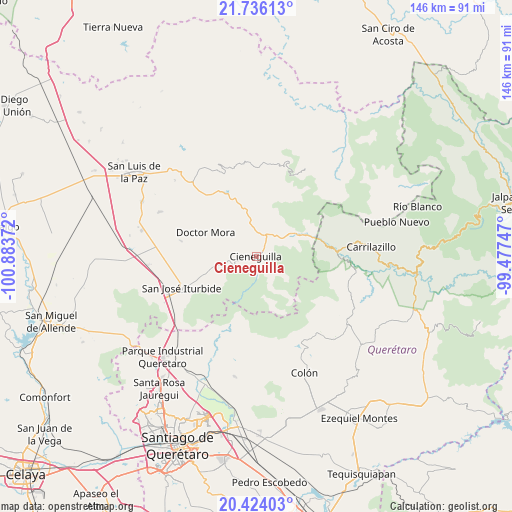
Cieneguilla GPS coordinates[2]
21° 4' 53.508" North, 100° 10' 50.124" West
| Map corner | latitude | longitude |
|---|---|---|
| Upper-left | 21.73613°, | -100.88372° |
| Center: | 21.08153°, | -100.18059° |
| Lower-right: | 20.42403°, | -99.47747° |
| Map W x H: | 145.9×145.9 km | = 90.7×90.7mi |
| max Lat: | 32.7° ⇑22.4% North |
| Cieneguilla: | 21.08153° |
| min Lat: | ⇓77.6% South 14.53588° |
| min Long | Cieneguilla | max Long |
| -117.105° | -100.18059° | -86.73105° |
| W 33.7%⇐ | ⇒66.3% E |
Elevation
Elevation of Cieneguilla is 1756 m = 5761 ft, and this is 502.3 m = 1648 ft above average elevation for this country.
| Max E: |
3497 m = 11473 ft | 38.2% |
| Cieneguilla | 1756 m 5761 ft | |
| Avg. | 1253.7 m = 4113 ft | |
Min E: |
-1 m = -3 ft | 61.8% |
See also: Mexico elevation on elevation.city.
Geographical zone
Cieneguilla is located in North Torrid zone (between Equator and Tropic of Cancer). Distance of this Northern Tropic circle is 261.9 km =162.7 mi to North.| Distance of | km | miles | from Cieneguilla |
|---|---|---|---|
| North Pole | 7663 | 4761.6 | to North |
| Arctic Circle | 5057.1 | 3142.3 | to North |
| Tropic Cancer | 261.9 | 162.7 | to North |
| Equator | 2344 | 1456.5 | to South |


Nearby cities:
15 places around Cieneguilla: (largest is in red/bold)
• Cano de San Isidro
4.5 km =2.8 mi,  256°
256°
• Carbajal
9.9 km =6.2 mi,  252°
252°
• Cerro Colorado
5.9 km =3.7 mi,  294°
294°
• Cuesta de Peñones
5.8 km =3.6 mi,  272°
272°
• Derramadero de Charcas
13.6 km =8.5 mi,  282°
282°
• El Picacho
1.3 km =0.8 mi,  225°
225°
• Fracción de Guadalupe
6.2 km =3.9 mi,  28°
28°
• La Redonda
14.2 km =8.8 mi, 270°
• Las Moras
2 km =1.2 mi,  114°
114°
• Los Remedios
11.7 km =7.3 mi,  350°
350°
• Milpillas de Santiago
13.2 km =8.2 mi,  1°
1°
• Rincón de Cano
7 km =4.3 mi, 245°
• Santa Catarina
13.3 km =8.3 mi,  59°
59°
• Tierra Blanca
3 km =1.9 mi,  46°
46°
• Torrecitas
2 km =1.2 mi, 282°
Sources, notices
• [Note1] Compared only with cities in Mexico existing in our database
• [Src1] Map data: © OpenStreetMap contributors (CC-BY-SA)
• [Src2] Other city data from geonames.org with taken over terms of usage.
• [Src3] Geographical zone / Annual Mean Temperature by Robert A. Rohde @ Wikipedia
