Las Moras geodata
Las Moras (Guanajuato) is a populated place; located in Mexico in America/Mexico_City (GMT-6) time zone. With population of 666 people, there are 13039 cities with bigger population in this country. Compared to other cities in Mexico, 77.5% of cities are located further ↓South; 66% of cities are located further →East and 61.1% of cities have lower elevation than Las Moras. Note1


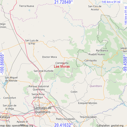
Las Moras GPS coordinates[2]
21° 4' 25.86" North, 100° 9' 46.512" West
| Map corner | latitude | longitude |
|---|---|---|
| Upper-left | 21.72849°, | -100.86605° |
| Center: | 21.07385°, | -100.16292° |
| Lower-right: | 20.41632°, | -99.4598° |
| Map W x H: | 145.9×145.9 km | = 90.7×90.7mi |
| max Lat: | 32.7° ⇑22.5% North |
| Las Moras: | 21.07385° |
| min Lat: | ⇓77.5% South 14.53588° |
| min Long | Las Moras | max Long |
| -117.105° | -100.16292° | -86.73105° |
| W 34%⇐ | ⇒66% E |
Elevation
Elevation of Las Moras is 1746 m = 5728 ft, and this is 492.3 m = 1615 ft above average elevation for this country.
| Max E: |
3497 m = 11473 ft | 38.9% |
| Las Moras | 1746 m 5728 ft | |
| Avg. | 1253.7 m = 4113 ft | |
Min E: |
-1 m = -3 ft | 61.1% |
See also: Mexico elevation on elevation.city.
Geographical zone
Las Moras is located in North Torrid zone (between Equator and Tropic of Cancer). Distance of this Northern Tropic circle is 262.7 km =163.2 mi to North.| Distance of | km | miles | from Las Moras |
|---|---|---|---|
| North Pole | 7663.9 | 4762.1 | to North |
| Arctic Circle | 5058 | 3142.9 | to North |
| Tropic Cancer | 262.7 | 163.2 | to North |
| Equator | 2343.2 | 1456 | to South |


Nearby cities:
15 places around Las Moras: (largest is in red/bold)
• Cano de San Isidro
6.2 km =3.9 mi,  268°
268°
• Carbajal
11.4 km =7.1 mi,  259°
259°
• Cerro Colorado
7.9 km =4.9 mi,  294°
294°
• Cieneguilla
2 km =1.2 mi, 294°
• Cuesta de Peñones
7.7 km =4.8 mi,  278°
278°
• Derramadero de Charcas
15.6 km =9.7 mi, 284°
• El Picacho
2.8 km =1.7 mi, 268°
• Fracción de Guadalupe
6.4 km =4 mi,  10°
10°
• La Redonda
16 km =9.9 mi, 273°
• Los Remedios
12.9 km =8 mi,  343°
343°
• Milpillas de Santiago
14.2 km =8.8 mi,  353°
353°
• Rincón de Cano
8.5 km =5.3 mi, 255°
• Santa Catarina
12.3 km =7.6 mi,  51°
51°
• Tierra Blanca
2.9 km =1.8 mi, 7°
• Torrecitas
4 km =2.5 mi, 288°
Sources, notices
• [Note1] Compared only with cities in Mexico existing in our database
• [Src1] Map data: © OpenStreetMap contributors (CC-BY-SA)
• [Src2] Other city data from geonames.org with taken over terms of usage.
• [Src3] Geographical zone / Annual Mean Temperature by Robert A. Rohde @ Wikipedia
