San Ernesto geodata
San Ernesto (Guanajuato) is a populated place; located in Mexico in America/Mexico_City (GMT-6) time zone. With population of 599 people, there are 14365 cities with bigger population in this country. Compared to other cities in Mexico, 78.4% of cities are located further ↓South; 69.9% of cities are located further →East and 75.6% of cities have lower elevation than San Ernesto. Note1


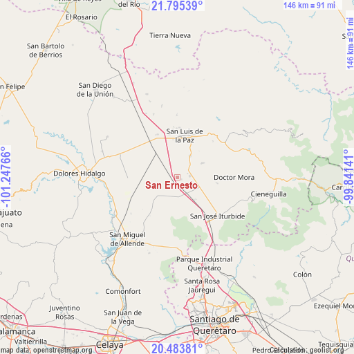
San Ernesto GPS coordinates[2]
21° 8' 27.78" North, 100° 32' 40.308" West
| Map corner | latitude | longitude |
|---|---|---|
| Upper-left | 21.79539°, | -101.24766° |
| Center: | 21.14105°, | -100.54453° |
| Lower-right: | 20.48381°, | -99.84141° |
| Map W x H: | 145.8×145.8 km | = 90.6×90.6mi |
| max Lat: | 32.7° ⇑21.6% North |
| San Ernesto: | 21.14105° |
| min Lat: | ⇓78.4% South 14.53588° |
| min Long | San Ernesto | max Long |
| -117.105° | -100.54453° | -86.73105° |
| W 30.1%⇐ | ⇒69.9% E |
Elevation
Elevation of San Ernesto is 2040 m = 6693 ft, and this is 786.3 m = 2580 ft above average elevation for this country.
| Max E: |
3497 m = 11473 ft | 24.4% |
| San Ernesto | 2040 m 6693 ft | |
| Avg. | 1253.7 m = 4113 ft | |
Min E: |
-1 m = -3 ft | 75.6% |
See also: Mexico elevation on elevation.city.
Geographical zone
San Ernesto is located in North Torrid zone (between Equator and Tropic of Cancer). Distance of this Northern Tropic circle is 255.3 km =158.6 mi to North.| Distance of | km | miles | from San Ernesto |
|---|---|---|---|
| North Pole | 7656.4 | 4757.5 | to North |
| Arctic Circle | 5050.5 | 3138.2 | to North |
| Tropic Cancer | 255.3 | 158.6 | to North |
| Equator | 2350.7 | 1460.7 | to South |


Nearby cities:
15 places around San Ernesto: (largest is in red/bold)
• Derramadero Segundo (Infiernillo)
5.8 km =3.6 mi,  146°
146°
• El Fraile
7.4 km =4.6 mi,  221°
221°
• El Varal (La Merced)
12.1 km =7.5 mi,  60°
60°
• Estancia de San Antonio
13.6 km =8.5 mi,  206°
206°
• Galomo
14.4 km =8.9 mi,  128°
128°
• La Laguna
9.1 km =5.7 mi,  105°
105°
• La Luz de la Esquina
5 km =3.1 mi,  88°
88°
• Purísima de Cerro Grande
14 km =8.7 mi,  4°
4°
• San Antonio Primero
5.5 km =3.4 mi,  162°
162°
• San Isidro de la Estacada
14.6 km =9.1 mi,  272°
272°
• San Miguelito
10 km =6.2 mi, 205°
• San Nicolás del Cármen
14.8 km =9.2 mi,  357°
357°
• San Sebastián de Salitre
7.9 km =4.9 mi,  122°
122°
• Tulillos de Abajo
8.8 km =5.5 mi, 134°
• Tulillos de Arriba
11 km =6.8 mi,  135°
135°
Sources, notices
• [Note1] Compared only with cities in Mexico existing in our database
• [Src1] Map data: © OpenStreetMap contributors (CC-BY-SA)
• [Src2] Other city data from geonames.org with taken over terms of usage.
• [Src3] Geographical zone / Annual Mean Temperature by Robert A. Rohde @ Wikipedia
