San Sebastián de Salitre geodata
San Sebastián de Salitre (Guanajuato) is a populated place; located in Mexico in America/Mexico_City (GMT-6) time zone. With population of 1,863 people, there are 4658 cities with bigger population in this country. Compared to other cities in Mexico, 77.9% of cities are located further ↓South; 69.3% of cities are located further →East and 74.9% of cities have lower elevation than San Sebastián de Salitre. Note1
Current local time in San Sebastián de Salitre:
11:17 AM, MondayDifference from your time zone: hours


San Sebastián de Salitre GPS coordinates[2]
21° 6' 10.008" North, 100° 28' 51.096" West
| Map corner | latitude | longitude |
|---|---|---|
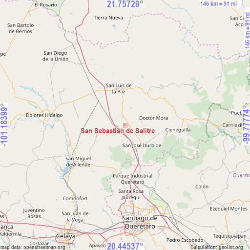
| Upper-left | 21.75729°, | -101.18399° |
| Center: | 21.10278°, | -100.48086° |
| Lower-right: | 20.44537°, | -99.77774° |
| Map W x H: | 145.9×145.9 km | = 90.7×90.7mi |
| max Lat: | 32.7° ⇑22.1% North |
| San Sebastián de Salitre: | 21.10278° |
| min Lat: | ⇓77.9% South 14.53588° |
| min Long | San Sebastián | max Long |
| -117.105° | -100.48086° | -86.73105° |
| W 30.7%⇐ | ⇒69.3% E |
Elevation
Elevation of San Sebastián de Salitre is 2028 m = 6654 ft, and this is 774.3 m = 2540 ft above average elevation for this country.
| Max E: |
3497 m = 11473 ft | 25.1% |
| San Sebastián de Salitre | 2028 m 6654 ft | |
| Avg. | 1253.7 m = 4113 ft | |
Min E: |
-1 m = -3 ft | 74.9% |
See also: Mexico elevation on elevation.city.
Geographical zone
San Sebastián de Salitre is located in North Torrid zone (between Equator and Tropic of Cancer). Distance of this Northern Tropic circle is 259.5 km =161.2 mi to North.| Distance of | km | miles | from San Sebastián de Salitre |
|---|---|---|---|
| North Pole | 7660.7 | 4760.1 | to North |
| Arctic Circle | 5054.8 | 3140.9 | to North |
| Tropic Cancer | 259.5 | 161.2 | to North |
| Equator | 2346.4 | 1458 | to South |


Nearby cities:
15 places around San Sebastián de Salitre: (largest is in red/bold)
• Cinco de Mayo
11.6 km =7.2 mi,  144°
144°
• Derramadero Segundo (Infiernillo)
3.5 km =2.2 mi,  260°
260°
• El Fraile
11.6 km =7.2 mi, 263°
• El Varal (La Merced)
10.9 km =6.8 mi,  21°
21°
• Galomo
6.7 km =4.2 mi,  134°
134°
• La Laguna
2.8 km =1.7 mi,  50°
50°
• La Luz de la Esquina
4.7 km =2.9 mi,  340°
340°
• La Noria
10.2 km =6.3 mi,  79°
79°
• La Reforma
10.8 km =6.7 mi,  120°
120°
• Las Adjuntas
8.4 km =5.2 mi, 123°
• Pueblo Nuevo
7.7 km =4.8 mi,  92°
92°
• San Antonio Primero
5 km =3.1 mi, 259°
• San Ernesto
7.9 km =4.9 mi,  302°
302°
• Tulillos de Abajo
1.9 km =1.2 mi,  190°
190°
• Tulillos de Arriba
3.7 km =2.3 mi,  161°
161°
Sources, notices
• [Note1] Compared only with cities in Mexico existing in our database
• [Src1] Map data: © OpenStreetMap contributors (CC-BY-SA)
• [Src2] Other city data from geonames.org with taken over terms of usage.
• [Src3] Geographical zone / Annual Mean Temperature by Robert A. Rohde @ Wikipedia
