El Puente geodata
El Puente (Guanajuato) is a populated place; located in Mexico in America/Mexico_City (GMT-6) time zone. With population of 627 people, there are 13802 cities with bigger population in this country. Compared to other cities in Mexico, 76.9% of cities are located further ↓South; 79.1% of cities are located further →East and 63% of cities have lower elevation than El Puente. Note1


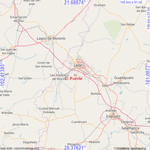
El Puente GPS coordinates[2]
21° 2' 2.112" North, 101° 42' 38.952" West
| Map corner | latitude | longitude |
|---|---|---|
| Upper-left | 21.68874°, | -102.41395° |
| Center: | 21.03392°, | -101.71082° |
| Lower-right: | 20.37621°, | -101.0077° |
| Map W x H: | 145.9×145.9 km | = 90.7×90.7mi |
| max Lat: | 32.7° ⇑23.1% North |
| El Puente: | 21.03392° |
| min Lat: | ⇓76.9% South 14.53588° |
| min Long | El Puente | max Long |
| -117.105° | -101.71082° | -86.73105° |
| W 20.9%⇐ | ⇒79.1% E |
Elevation
Elevation of El Puente is 1778 m = 5833 ft, and this is 524.3 m = 1720 ft above average elevation for this country.
| Max E: |
3497 m = 11473 ft | 37% |
| El Puente | 1778 m 5833 ft | |
| Avg. | 1253.7 m = 4113 ft | |
Min E: |
-1 m = -3 ft | 63% |
See also: Mexico elevation on elevation.city.
Geographical zone
El Puente is located in North Torrid zone (between Equator and Tropic of Cancer). Distance of this Northern Tropic circle is 267.2 km =166 mi to North.| Distance of | km | miles | from El Puente |
|---|---|---|---|
| North Pole | 7668.3 | 4764.9 | to North |
| Arctic Circle | 5062.4 | 3145.6 | to North |
| Tropic Cancer | 267.2 | 166 | to North |
| Equator | 2338.8 | 1453.3 | to South |


Nearby cities:
15 places around El Puente: (largest is in red/bold)
• Colonia Latinoamericana
0.7 km =0.4 mi,  128°
128°
• El CERESO
2.6 km =1.6 mi,  120°
120°
• El Ramillete
5.9 km =3.7 mi,  276°
276°
• La Esmeralda
0.8 km =0.5 mi,  109°
109°
• La Reserva
6.3 km =3.9 mi,  325°
325°
• Los Arcos
2.9 km =1.8 mi,  53°
53°
• Malagana (San Antonio del Monte)
4.7 km =2.9 mi,  287°
287°
• Plan de Ayala
4.4 km =2.7 mi,  345°
345°
• Rústico San Pedro
0.5 km =0.3 mi,  96°
96°
• San Antonio de los Tepetates
3.8 km =2.4 mi,  71°
71°
• San Cristóbal
6.3 km =3.9 mi,  169°
169°
• San Isidro de las Colonias
1.2 km =0.7 mi, 283°
• San José de Durán (Los Troncoso)
5 km =3.1 mi, 49°
• San Pedro del Monte (La Huizachera)
0.5 km =0.3 mi,  236°
236°
• Santa Ana
4.6 km =2.9 mi, 52°
Sources, notices
• [Note1] Compared only with cities in Mexico existing in our database
• [Src1] Map data: © OpenStreetMap contributors (CC-BY-SA)
• [Src2] Other city data from geonames.org with taken over terms of usage.
• [Src3] Geographical zone / Annual Mean Temperature by Robert A. Rohde @ Wikipedia
