San Cristóbal geodata
San Cristóbal (Guanajuato) is a populated place; located in Mexico in America/Mexico_City (GMT-6) time zone. With population of 2,485 people, there are 3557 cities with bigger population in this country. Compared to other cities in Mexico, 76.2% of cities are located further ↓South; 79% of cities are located further →East and 62.8% of cities have lower elevation than San Cristóbal. Note1


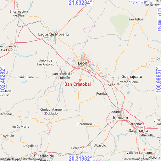
San Cristóbal GPS coordinates[2]
20° 58' 39.972" North, 101° 41' 58.884" West
| Map corner | latitude | longitude |
|---|---|---|
| Upper-left | 21.63284°, | -102.40282° |
| Center: | 20.97777°, | -101.69969° |
| Lower-right: | 20.31982°, | -100.99657° |
| Map W x H: | 146×146 km | = 90.7×90.7mi |
| max Lat: | 32.7° ⇑23.8% North |
| San Cristóbal: | 20.97777° |
| min Lat: | ⇓76.2% South 14.53588° |
| min Long | San Cristóbal | max Long |
| -117.105° | -101.69969° | -86.73105° |
| W 21%⇐ | ⇒79% E |
Elevation
Elevation of San Cristóbal is 1775 m = 5823 ft, and this is 521.3 m = 1710 ft above average elevation for this country.
| Max E: |
3497 m = 11473 ft | 37.2% |
| San Cristóbal | 1775 m 5823 ft | |
| Avg. | 1253.7 m = 4113 ft | |
Min E: |
-1 m = -3 ft | 62.8% |
See also: Mexico elevation on elevation.city.
Geographical zone
San Cristóbal is located in North Torrid zone (between Equator and Tropic of Cancer). Distance of this Northern Tropic circle is 273.4 km =169.9 mi to North.| Distance of | km | miles | from San Cristóbal |
|---|---|---|---|
| North Pole | 7674.6 | 4768.8 | to North |
| Arctic Circle | 5068.7 | 3149.5 | to North |
| Tropic Cancer | 273.4 | 169.9 | to North |
| Equator | 2332.5 | 1449.3 | to South |


Nearby cities:
15 places around San Cristóbal: (largest is in red/bold)
• Barretos
7.3 km =4.5 mi,  125°
125°
• Colonia Latinoamericana
5.9 km =3.7 mi,  353°
353°
• El CERESO
5.1 km =3.2 mi,  12°
12°
• El Puente
6.3 km =3.9 mi, 349°
• La Esmeralda
6 km =3.7 mi,  356°
356°
• Los Ramírez
7.4 km =4.6 mi,  51°
51°
• Nuevo Lindero
6.8 km =4.2 mi,  108°
108°
• Plan Guanajuato (La Sandía)
6.2 km =3.9 mi,  177°
177°
• Plan Libertador
3.3 km =2.1 mi,  145°
145°
• Rancho Nuevo de la Luz
5.9 km =3.7 mi, 106°
• Rústico San Pedro
6.2 km =3.9 mi, 354°
• San Antonio de los Tepetates
7.8 km =4.8 mi,  18°
18°
• San Isidro de las Colonias
6.9 km =4.3 mi,  340°
340°
• San José de la Calera
6.6 km =4.1 mi,  267°
267°
• San Pedro del Monte (La Huizachera)
6.2 km =3.9 mi, 345°
Sources, notices
• [Note1] Compared only with cities in Mexico existing in our database
• [Src1] Map data: © OpenStreetMap contributors (CC-BY-SA)
• [Src2] Other city data from geonames.org with taken over terms of usage.
• [Src3] Geographical zone / Annual Mean Temperature by Robert A. Rohde @ Wikipedia
