Pastor Ortíz geodata
Pastor Ortíz (Michoacán) is a seat of a second-order administrative division; located in Mexico in America/Mexico_City (GMT-6) time zone. With population of 6,630 people, there are 1411 cities with bigger population in this country. Compared to other cities in Mexico, 63.6% of cities are located further ↓South; 78.2% of cities are located further →East and 58.1% of cities have lower elevation than Pastor Ortíz. Note1


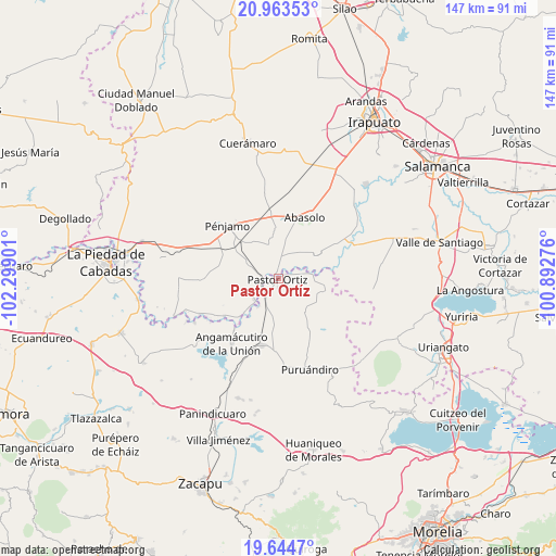
Pastor Ortíz GPS coordinates[2]
20° 18' 19.872" North, 101° 35' 45.168" West
| Map corner | latitude | longitude |
|---|---|---|
| Upper-left | 20.96353°, | -102.29901° |
| Center: | 20.30552°, | -101.59588° |
| Lower-right: | 19.6447°, | -100.89276° |
| Map W x H: | 146.6×146.6 km | = 91.1×91.1mi |
| max Lat: | 32.7° ⇑36.4% North |
| Pastor Ortíz: | 20.30552° |
| min Lat: | ⇓63.6% South 14.53588° |
| min Long | Pastor Ortíz | max Long |
| -117.105° | -101.59588° | -86.73105° |
| W 21.8%⇐ | ⇒78.2% E |
Elevation
Elevation of Pastor Ortíz is 1693 m = 5554 ft, and this is 439.3 m = 1441 ft above average elevation for this country.
| Max E: |
3497 m = 11473 ft | 41.9% |
| Pastor Ortíz | 1693 m 5554 ft | |
| Avg. | 1253.7 m = 4113 ft | |
Min E: |
-1 m = -3 ft | 58.1% |
See also: Mexico elevation on elevation.city.
Geographical zone
Pastor Ortíz is located in North Torrid zone (between Equator and Tropic of Cancer). Distance of this Northern Tropic circle is 348.2 km =216.4 mi to North.| Distance of | km | miles | from Pastor Ortíz |
|---|---|---|---|
| North Pole | 7749.3 | 4815.2 | to North |
| Arctic Circle | 5143.4 | 3196 | to North |
| Tropic Cancer | 348.2 | 216.4 | to North |
| Equator | 2257.8 | 1402.9 | to South |


Nearby cities:
15 places around Pastor Ortíz: (largest is in red/bold)
• Atarjea de Crucitas
5.2 km =3.2 mi,  281°
281°
• Cerritos de Aceves
3.3 km =2.1 mi,  317°
317°
• El Arco
6.2 km =3.9 mi,  157°
157°
• El Varal
4.8 km =3 mi,  354°
354°
• La Calera (Nacimientos)
4 km =2.5 mi,  147°
147°
• La Calle
4.8 km =3 mi,  243°
243°
• La Lobera
8.2 km =5.1 mi,  44°
44°
• Los Corrales
2.7 km =1.7 mi,  65°
65°
• Maritas
1.3 km =0.8 mi,  334°
334°
• Noria de Barajas
8.2 km =5.1 mi,  294°
294°
• Potreros
8.6 km =5.3 mi,  228°
228°
• Rancho de Guadalupe (El Gato)
5.8 km =3.6 mi, 41°
• Rincón de Martínez
3.1 km =1.9 mi, 36°
• Tafolla (José María Tafolla)
7.7 km =4.8 mi,  143°
143°
• Tres Mezquites
5.8 km =3.6 mi,  214°
214°
Sources, notices
• [Note1] Compared only with cities in Mexico existing in our database
• [Src1] Map data: © OpenStreetMap contributors (CC-BY-SA)
• [Src2] Other city data from geonames.org with taken over terms of usage.
• [Src3] Geographical zone / Annual Mean Temperature by Robert A. Rohde @ Wikipedia
