Los Corrales geodata
Los Corrales (Michoacán) is a populated place; located in Mexico in America/Mexico_City (GMT-6) time zone. With population of 635 people, there are 13639 cities with bigger population in this country. Compared to other cities in Mexico, 63.8% of cities are located further ↓South; 78% of cities are located further →East and 58.3% of cities have lower elevation than Los Corrales. Note1


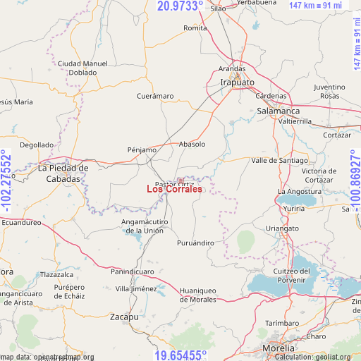
Los Corrales GPS coordinates[2]
20° 18' 55.188" North, 101° 34' 20.604" West
| Map corner | latitude | longitude |
|---|---|---|
| Upper-left | 20.9733°, | -102.27552° |
| Center: | 20.31533°, | -101.57239° |
| Lower-right: | 19.65455°, | -100.86927° |
| Map W x H: | 146.6×146.6 km | = 91.1×91.1mi |
| max Lat: | 32.7° ⇑36.2% North |
| Los Corrales: | 20.31533° |
| min Lat: | ⇓63.8% South 14.53588° |
| min Long | Los Corrales | max Long |
| -117.105° | -101.57239° | -86.73105° |
| W 22%⇐ | ⇒78% E |
Elevation
Elevation of Los Corrales is 1695 m = 5561 ft, and this is 441.3 m = 1448 ft above average elevation for this country.
| Max E: |
3497 m = 11473 ft | 41.7% |
| Los Corrales | 1695 m 5561 ft | |
| Avg. | 1253.7 m = 4113 ft | |
Min E: |
-1 m = -3 ft | 58.3% |
See also: Mexico elevation on elevation.city.
Geographical zone
Los Corrales is located in North Torrid zone (between Equator and Tropic of Cancer). Distance of this Northern Tropic circle is 347.1 km =215.7 mi to North.| Distance of | km | miles | from Los Corrales |
|---|---|---|---|
| North Pole | 7748.2 | 4814.5 | to North |
| Arctic Circle | 5142.3 | 3195.3 | to North |
| Tropic Cancer | 347.1 | 215.7 | to North |
| Equator | 2258.9 | 1403.6 | to South |


Nearby cities:
15 places around Los Corrales: (largest is in red/bold)
• Atarjea de Crucitas
7.6 km =4.7 mi,  269°
269°
• Cerritos de Aceves
4.9 km =3 mi,  285°
285°
• El Arco
6.8 km =4.2 mi,  180°
180°
• El Varal
4.7 km =2.9 mi,  321°
321°
• Héroes de Chapultepec (Rodeo de San Antonio)
7.3 km =4.5 mi,  93°
93°
• Joroches (Joroches Nuevo)
6.8 km =4.2 mi,  76°
76°
• La Calera (Nacimientos)
4.5 km =2.8 mi, 184°
• La Calle
7.5 km =4.7 mi,  244°
244°
• La Lobera
5.8 km =3.6 mi,  35°
35°
• Maritas
3 km =1.9 mi, 271°
• Monte Blanco
6.4 km =4 mi,  46°
46°
• Pastor Ortíz
2.7 km =1.7 mi,  245°
245°
• Rancho de Guadalupe (El Gato)
3.5 km =2.2 mi,  22°
22°
• Rincón de Martínez
1.5 km =0.9 mi,  336°
336°
• Tafolla (José María Tafolla)
7.6 km =4.7 mi,  163°
163°
Sources, notices
• [Note1] Compared only with cities in Mexico existing in our database
• [Src1] Map data: © OpenStreetMap contributors (CC-BY-SA)
• [Src2] Other city data from geonames.org with taken over terms of usage.
• [Src3] Geographical zone / Annual Mean Temperature by Robert A. Rohde @ Wikipedia
