El Jaralillo geodata
El Jaralillo (Guanajuato) is a populated place; located in Mexico in America/Mexico_City (GMT-6) time zone. With population of 764 people, there are 11465 cities with bigger population in this country. Compared to other cities in Mexico, 71.1% of cities are located further ↓South; 73.3% of cities are located further →East and 63.4% of cities have lower elevation than El Jaralillo. Note1


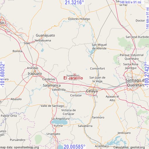
El Jaralillo GPS coordinates[2]
20° 39' 54.54" North, 100° 58' 38.604" West
| Map corner | latitude | longitude |
|---|---|---|
| Upper-left | 21.3216°, | -101.68052° |
| Center: | 20.66515°, | -100.97739° |
| Lower-right: | 20.00585°, | -100.27427° |
| Map W x H: | 146.3×146.3 km | = 90.9×90.9mi |
| max Lat: | 32.7° ⇑28.9% North |
| El Jaralillo: | 20.66515° |
| min Lat: | ⇓71.1% South 14.53588° |
| min Long | El Jaralillo | max Long |
| -117.105° | -100.97739° | -86.73105° |
| W 26.7%⇐ | ⇒73.3% E |
Elevation
Elevation of El Jaralillo is 1788 m = 5866 ft, and this is 534.3 m = 1753 ft above average elevation for this country.
| Max E: |
3497 m = 11473 ft | 36.6% |
| El Jaralillo | 1788 m 5866 ft | |
| Avg. | 1253.7 m = 4113 ft | |
Min E: |
-1 m = -3 ft | 63.4% |
See also: Mexico elevation on elevation.city.
Geographical zone
El Jaralillo is located in North Torrid zone (between Equator and Tropic of Cancer). Distance of this Northern Tropic circle is 308.2 km =191.5 mi to North.| Distance of | km | miles | from El Jaralillo |
|---|---|---|---|
| North Pole | 7709.3 | 4790.3 | to North |
| Arctic Circle | 5103.4 | 3171.1 | to North |
| Tropic Cancer | 308.2 | 191.5 | to North |
| Equator | 2297.7 | 1427.7 | to South |


Nearby cities:
15 places around El Jaralillo: (largest is in red/bold)
• Cañada del Agua
7.5 km =4.7 mi,  56°
56°
• Don Diego
8.6 km =5.3 mi,  65°
65°
• El Murciélago
3.4 km =2.1 mi,  354°
354°
• El Naranjillo
6 km =3.7 mi,  336°
336°
• Emiliano Zapata
8.7 km =5.4 mi,  232°
232°
• Franco Tavera
8.4 km =5.2 mi,  141°
141°
• Juventino Rosas
2.9 km =1.8 mi,  213°
213°
• La Purísima
8.4 km =5.2 mi,  243°
243°
• Los Dulces Nombres
2.3 km =1.4 mi,  145°
145°
• Pocitos de Corrales
7 km =4.3 mi,  29°
29°
• San Antonio de Romerillo
7 km =4.3 mi, 154°
• San Diego de los Dolores
8.6 km =5.3 mi,  321°
321°
• San José de las Pilas
7.2 km =4.5 mi,  258°
258°
• San Juan de la Cruz
7.6 km =4.7 mi,  115°
115°
• Santiago de Cuenda
7.5 km =4.7 mi,  193°
193°
Sources, notices
• [Note1] Compared only with cities in Mexico existing in our database
• [Src1] Map data: © OpenStreetMap contributors (CC-BY-SA)
• [Src2] Other city data from geonames.org with taken over terms of usage.
• [Src3] Geographical zone / Annual Mean Temperature by Robert A. Rohde @ Wikipedia
