Los Dulces Nombres geodata
Los Dulces Nombres (Guanajuato) is a populated place; located in Mexico in America/Mexico_City (GMT-6) time zone. With population of 1,258 people, there are 6880 cities with bigger population in this country. Compared to other cities in Mexico, 70.9% of cities are located further ↓South; 73.2% of cities are located further →East and 62.5% of cities have lower elevation than Los Dulces Nombres. Note1


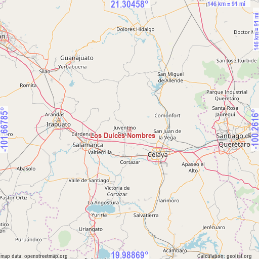
Los Dulces Nombres GPS coordinates[2]
20° 38' 53.016" North, 100° 57' 52.992" West
| Map corner | latitude | longitude |
|---|---|---|
| Upper-left | 21.30458°, | -101.66785° |
| Center: | 20.64806°, | -100.96472° |
| Lower-right: | 19.98869°, | -100.2616° |
| Map W x H: | 146.3×146.3 km | = 90.9×90.9mi |
| max Lat: | 32.7° ⇑29.1% North |
| Los Dulces Nombres: | 20.64806° |
| min Lat: | ⇓70.9% South 14.53588° |
| min Long | Los Dulces Nomb | max Long |
| -117.105° | -100.96472° | -86.73105° |
| W 26.8%⇐ | ⇒73.2% E |
Elevation
Elevation of Los Dulces Nombres is 1768 m = 5801 ft, and this is 514.3 m = 1687 ft above average elevation for this country.
| Max E: |
3497 m = 11473 ft | 37.5% |
| Los Dulces Nombres | 1768 m 5801 ft | |
| Avg. | 1253.7 m = 4113 ft | |
Min E: |
-1 m = -3 ft | 62.5% |
See also: Mexico elevation on elevation.city.
Geographical zone
Los Dulces Nombres is located in North Torrid zone (between Equator and Tropic of Cancer). Distance of this Northern Tropic circle is 310.1 km =192.7 mi to North.| Distance of | km | miles | from Los Dulces Nombres |
|---|---|---|---|
| North Pole | 7711.2 | 4791.5 | to North |
| Arctic Circle | 5105.3 | 3172.3 | to North |
| Tropic Cancer | 310.1 | 192.7 | to North |
| Equator | 2295.8 | 1426.5 | to South |


Nearby cities:
15 places around Los Dulces Nombres: (largest is in red/bold)
• Cañada del Agua
7.8 km =4.8 mi,  39°
39°
• Don Diego
8.6 km =5.3 mi,  49°
49°
• El Jaralillo
2.3 km =1.4 mi,  325°
325°
• El Murciélago
5.6 km =3.5 mi,  342°
342°
• El Naranjillo
8.2 km =5.1 mi, 333°
• Franco Tavera
6.1 km =3.8 mi,  140°
140°
• Juventino Rosas
3 km =1.9 mi,  259°
259°
• Pocitos de Corrales
8.3 km =5.2 mi,  14°
14°
• Pozos
7.8 km =4.8 mi,  113°
113°
• Rincón del Centeno
8.4 km =5.2 mi,  80°
80°
• San Antonio de Romerillo
4.8 km =3 mi,  159°
159°
• San José de Manantiales
7.9 km =4.9 mi,  134°
134°
• San José de las Pilas
8.4 km =5.2 mi,  273°
273°
• San Juan de la Cruz
5.7 km =3.5 mi,  104°
104°
• Santiago de Cuenda
6.2 km =3.9 mi,  209°
209°
Sources, notices
• [Note1] Compared only with cities in Mexico existing in our database
• [Src1] Map data: © OpenStreetMap contributors (CC-BY-SA)
• [Src2] Other city data from geonames.org with taken over terms of usage.
• [Src3] Geographical zone / Annual Mean Temperature by Robert A. Rohde @ Wikipedia
