San Gonzalo geodata
San Gonzalo (Guanajuato) is a populated place; located in Mexico in America/Mexico_City (GMT-6) time zone. With population of 580 people, there are 14779 cities with bigger population in this country. Compared to other cities in Mexico, 74.6% of cities are located further ↓South; 77.9% of cities are located further →East and 63.4% of cities have lower elevation than San Gonzalo. Note1


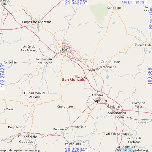
San Gonzalo GPS coordinates[2]
20° 53' 14.208" North, 101° 34' 16.032" West
| Map corner | latitude | longitude |
|---|---|---|
| Upper-left | 21.54275°, | -102.27425° |
| Center: | 20.88728°, | -101.57112° |
| Lower-right: | 20.22894°, | -100.868° |
| Map W x H: | 146.1×146.1 km | = 90.8×90.8mi |
| max Lat: | 32.7° ⇑25.4% North |
| San Gonzalo: | 20.88728° |
| min Lat: | ⇓74.6% South 14.53588° |
| min Long | San Gonzalo | max Long |
| -117.105° | -101.57112° | -86.73105° |
| W 22.1%⇐ | ⇒77.9% E |
Elevation
Elevation of San Gonzalo is 1787 m = 5863 ft, and this is 533.3 m = 1750 ft above average elevation for this country.
| Max E: |
3497 m = 11473 ft | 36.6% |
| San Gonzalo | 1787 m 5863 ft | |
| Avg. | 1253.7 m = 4113 ft | |
Min E: |
-1 m = -3 ft | 63.4% |
See also: Mexico elevation on elevation.city.
Geographical zone
San Gonzalo is located in North Torrid zone (between Equator and Tropic of Cancer). Distance of this Northern Tropic circle is 283.5 km =176.2 mi to North.| Distance of | km | miles | from San Gonzalo |
|---|---|---|---|
| North Pole | 7684.6 | 4775 | to North |
| Arctic Circle | 5078.7 | 3155.8 | to North |
| Tropic Cancer | 283.5 | 176.2 | to North |
| Equator | 2322.4 | 1443.1 | to South |


Nearby cities:
15 places around San Gonzalo: (largest is in red/bold)
• Colonia Rafael Corrales Ayala
5.9 km =3.7 mi,  74°
74°
• Cruz de Aguilar
8.4 km =5.2 mi,  196°
196°
• El Camaleón
6.4 km =4 mi,  270°
270°
• El Escoplo
6.7 km =4.2 mi, 67°
• El Jaguey
7.2 km =4.5 mi,  295°
295°
• El Mármol
4.8 km =3 mi,  190°
190°
• Gavia de Rionda
7.6 km =4.7 mi,  218°
218°
• La Arcina
7.5 km =4.7 mi,  323°
323°
• Lourdes
3.3 km =2.1 mi,  225°
225°
• Romita
5.9 km =3.7 mi,  107°
107°
• San Carlos del Jagüey
7.2 km =4.5 mi,  290°
290°
• San Clemente
9 km =5.6 mi,  159°
159°
• San Francisco Puerta Grande
9.2 km =5.7 mi,  97°
97°
• San Miguel del Guaricho
6.2 km =3.9 mi,  145°
145°
• Silva
2.3 km =1.4 mi, 66°
Sources, notices
• [Note1] Compared only with cities in Mexico existing in our database
• [Src1] Map data: © OpenStreetMap contributors (CC-BY-SA)
• [Src2] Other city data from geonames.org with taken over terms of usage.
• [Src3] Geographical zone / Annual Mean Temperature by Robert A. Rohde @ Wikipedia
