Medio Sitio geodata
Medio Sitio (Guanajuato) is a populated place; located in Mexico in America/Mexico_City (GMT-6) time zone. With population of 1,490 people, there are 5789 cities with bigger population in this country. Compared to other cities in Mexico, 74.3% of cities are located further ↓South; 76.1% of cities are located further →East and 63% of cities have lower elevation than Medio Sitio. Note1


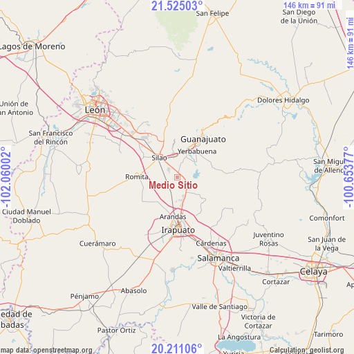
Medio Sitio GPS coordinates[2]
20° 52' 10.128" North, 101° 21' 24.804" West
| Map corner | latitude | longitude |
|---|---|---|
| Upper-left | 21.52503°, | -102.06002° |
| Center: | 20.86948°, | -101.35689° |
| Lower-right: | 20.21106°, | -100.65377° |
| Map W x H: | 146.1×146.1 km | = 90.8×90.8mi |
| max Lat: | 32.7° ⇑25.7% North |
| Medio Sitio: | 20.86948° |
| min Lat: | ⇓74.3% South 14.53588° |
| min Long | Medio Sitio | max Long |
| -117.105° | -101.35689° | -86.73105° |
| W 23.9%⇐ | ⇒76.1% E |
Elevation
Elevation of Medio Sitio is 1778 m = 5833 ft, and this is 524.3 m = 1720 ft above average elevation for this country.
| Max E: |
3497 m = 11473 ft | 37% |
| Medio Sitio | 1778 m 5833 ft | |
| Avg. | 1253.7 m = 4113 ft | |
Min E: |
-1 m = -3 ft | 63% |
See also: Mexico elevation on elevation.city.
Geographical zone
Medio Sitio is located in North Torrid zone (between Equator and Tropic of Cancer). Distance of this Northern Tropic circle is 285.5 km =177.4 mi to North.| Distance of | km | miles | from Medio Sitio |
|---|---|---|---|
| North Pole | 7686.6 | 4776.2 | to North |
| Arctic Circle | 5080.7 | 3157 | to North |
| Tropic Cancer | 285.5 | 177.4 | to North |
| Equator | 2320.5 | 1441.9 | to South |


Nearby cities:
15 places around Medio Sitio: (largest is in red/bold)
• Capulín de Bustos
5.4 km =3.4 mi,  74°
74°
• El Espejo
2.3 km =1.4 mi,  352°
352°
• El Nuevo Refugio
5.1 km =3.2 mi,  307°
307°
• Guadalupe Villa Cárdenas
3.9 km =2.4 mi,  170°
170°
• Hacienda Guadalupe
4.5 km =2.8 mi,  136°
136°
• La Calaverna
2 km =1.2 mi,  342°
342°
• Los Nicolases
4.3 km =2.7 mi,  107°
107°
• Molino de Santa Ana
4.6 km =2.9 mi, 170°
• Rancho Nuevo del Llanito
5.2 km =3.2 mi,  193°
193°
• San Andrés de la Baraña
1.6 km =1 mi,  44°
44°
• San Antonio el Rico
5.4 km =3.4 mi,  196°
196°
• San Diego
5.9 km =3.7 mi,  290°
290°
• San Ignacio
5.1 km =3.2 mi,  357°
357°
• San José de Llanos
5.2 km =3.2 mi, 107°
• San Vicente
4.8 km =3 mi,  160°
160°
Sources, notices
• [Note1] Compared only with cities in Mexico existing in our database
• [Src1] Map data: © OpenStreetMap contributors (CC-BY-SA)
• [Src2] Other city data from geonames.org with taken over terms of usage.
• [Src3] Geographical zone / Annual Mean Temperature by Robert A. Rohde @ Wikipedia
