San Vicente geodata
San Vicente (Guanajuato) is a populated place; located in Mexico in America/Mexico_City (GMT-6) time zone. With population of 1,673 people, there are 5190 cities with bigger population in this country. Compared to other cities in Mexico, 73.7% of cities are located further ↓South; 76% of cities are located further →East and 63.3% of cities have lower elevation than San Vicente. Note1


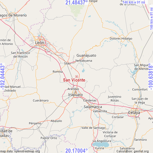
San Vicente GPS coordinates[2]
20° 49' 43.104" North, 101° 20' 28.68" West
| Map corner | latitude | longitude |
|---|---|---|
| Upper-left | 21.48437°, | -102.04443° |
| Center: | 20.82864°, | -101.3413° |
| Lower-right: | 20.17004°, | -100.63818° |
| Map W x H: | 146.1×146.1 km | = 90.8×90.8mi |
| max Lat: | 32.7° ⇑26.3% North |
| San Vicente: | 20.82864° |
| min Lat: | ⇓73.7% South 14.53588° |
| min Long | San Vicente | max Long |
| -117.105° | -101.3413° | -86.73105° |
| W 24%⇐ | ⇒76% E |
Elevation
Elevation of San Vicente is 1783 m = 5850 ft, and this is 529.3 m = 1737 ft above average elevation for this country.
| Max E: |
3497 m = 11473 ft | 36.7% |
| San Vicente | 1783 m 5850 ft | |
| Avg. | 1253.7 m = 4113 ft | |
Min E: |
-1 m = -3 ft | 63.3% |
See also: Mexico elevation on elevation.city.
Geographical zone
San Vicente is located in North Torrid zone (between Equator and Tropic of Cancer). Distance of this Northern Tropic circle is 290 km =180.2 mi to North.| Distance of | km | miles | from San Vicente |
|---|---|---|---|
| North Pole | 7691.1 | 4779 | to North |
| Arctic Circle | 5085.2 | 3159.8 | to North |
| Tropic Cancer | 290 | 180.2 | to North |
| Equator | 2315.9 | 1439 | to South |


Nearby cities:
15 places around San Vicente: (largest is in red/bold)
• Aldama
3.1 km =1.9 mi,  116°
116°
• Guadalupe Villa Cárdenas
1.2 km =0.7 mi,  306°
306°
• Hacienda Guadalupe
1.9 km =1.2 mi,  50°
50°
• Hacienda de Márquez
5.7 km =3.5 mi,  199°
199°
• La Calera
3.2 km =2 mi,  162°
162°
• Lo de Juárez
6.7 km =4.2 mi,  179°
179°
• Los Nicolases
4.1 km =2.5 mi,  37°
37°
• Medio Sitio
4.8 km =3 mi,  340°
340°
• Molino de Santa Ana
0.8 km =0.5 mi,  270°
270°
• Purísima del Progreso
4.1 km =2.5 mi, 163°
• Rancho Nuevo del Llanito
2.9 km =1.8 mi,  258°
258°
• San Andrés de la Baraña
5.7 km =3.5 mi,  355°
355°
• San Antonio el Rico
3.2 km =2 mi, 258°
• San José de Llanos
4.5 km =2.8 mi, 48°
• Taretán
5.6 km =3.5 mi,  173°
173°
Sources, notices
• [Note1] Compared only with cities in Mexico existing in our database
• [Src1] Map data: © OpenStreetMap contributors (CC-BY-SA)
• [Src2] Other city data from geonames.org with taken over terms of usage.
• [Src3] Geographical zone / Annual Mean Temperature by Robert A. Rohde @ Wikipedia
