San Ignacio geodata
San Ignacio (Guanajuato) is a populated place; located in Mexico in America/Mexico_City (GMT-6) time zone. With population of 557 people, there are 15314 cities with bigger population in this country. Compared to other cities in Mexico, 75.1% of cities are located further ↓South; 76.1% of cities are located further →East and 64.1% of cities have lower elevation than San Ignacio. Note1


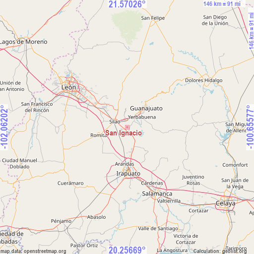
San Ignacio GPS coordinates[2]
20° 54' 53.676" North, 101° 21' 32.004" West
| Map corner | latitude | longitude |
|---|---|---|
| Upper-left | 21.57026°, | -102.06202° |
| Center: | 20.91491°, | -101.35889° |
| Lower-right: | 20.25669°, | -100.65577° |
| Map W x H: | 146.1×146.1 km | = 90.8×90.8mi |
| max Lat: | 32.7° ⇑24.9% North |
| San Ignacio: | 20.91491° |
| min Lat: | ⇓75.1% South 14.53588° |
| min Long | San Ignacio | max Long |
| -117.105° | -101.35889° | -86.73105° |
| W 23.9%⇐ | ⇒76.1% E |
Elevation
Elevation of San Ignacio is 1803 m = 5915 ft, and this is 549.3 m = 1802 ft above average elevation for this country.
| Max E: |
3497 m = 11473 ft | 35.9% |
| San Ignacio | 1803 m 5915 ft | |
| Avg. | 1253.7 m = 4113 ft | |
Min E: |
-1 m = -3 ft | 64.1% |
See also: Mexico elevation on elevation.city.
Geographical zone
San Ignacio is located in North Torrid zone (between Equator and Tropic of Cancer). Distance of this Northern Tropic circle is 280.4 km =174.2 mi to North.| Distance of | km | miles | from San Ignacio |
|---|---|---|---|
| North Pole | 7681.5 | 4773.1 | to North |
| Arctic Circle | 5075.7 | 3153.9 | to North |
| Tropic Cancer | 280.4 | 174.2 | to North |
| Equator | 2325.5 | 1445 | to South |


Nearby cities:
15 places around San Ignacio: (largest is in red/bold)
• Aguas Buenas
6.3 km =3.9 mi,  347°
347°
• Cañada de Bustos
4.9 km =3 mi,  103°
103°
• Cerritos
5.4 km =3.4 mi,  300°
300°
• El Espejo
2.8 km =1.7 mi,  181°
181°
• El Nuevo Refugio
4.3 km =2.7 mi,  243°
243°
• La Calaverna
3.2 km =2 mi,  186°
186°
• La Soledad
5.6 km =3.5 mi,  260°
260°
• Los Rodríguez
2.4 km =1.5 mi, 350°
• Medio Sitio
5.1 km =3.2 mi, 177°
• Menores
3.8 km =2.4 mi,  279°
279°
• San Andrés de la Baraña
4.1 km =2.5 mi,  160°
160°
• San Diego
6 km =3.7 mi, 240°
• San José de Tránsito
3.4 km =2.1 mi,  57°
57°
• San Marcos
2.9 km =1.8 mi,  31°
31°
• Villas de Guadalupe
6.1 km =3.8 mi,  309°
309°
Sources, notices
• [Note1] Compared only with cities in Mexico existing in our database
• [Src1] Map data: © OpenStreetMap contributors (CC-BY-SA)
• [Src2] Other city data from geonames.org with taken over terms of usage.
• [Src3] Geographical zone / Annual Mean Temperature by Robert A. Rohde @ Wikipedia
